

Accueil > Nos Actions > Journal de Bord des Opérations > Vacances Scientifiques > Iceland Lab du 7 au 21 juillet 2019
Le Journal de Bord
Sunday, July 7th, 2019
Arrivée des participants à Reykjavik.
Tous les participants ont bien été récupérés à l’aéroport et s’endorment tranquillement au camping de Reykjavik, sous les rayons du soleil d’été islandais qui nous fait croire qu’on ne fait que commencer la soirée.
Monday, July 8th, 2019
Today, we woke up at 8 am to enjoy the first breakfast of the trip.
After that, Fulvia gave us the rules of the life in the camp.
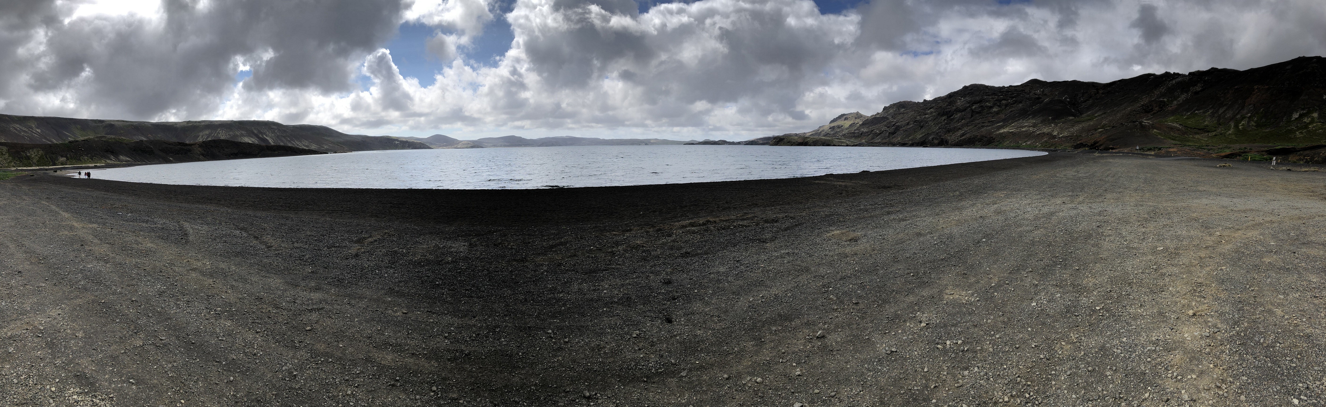
Then, we went to a lake which has a particularity : his level changes a lot during the year and scientists can not explain that. Then, we went to Reykjanes Peninsula and there were sulfur spots that smelt of rotten eggs ; we had our lunch there.
We made a very long walk of 12 km and saw beautiful landscapes. We got a bit lost but we finally found our way to get back to the car park.
We went back to the camping, it started to rain, we ate and went slepping.
Mathieu, Aurèle and Gaspard
Tuesday, July 9th, 2019
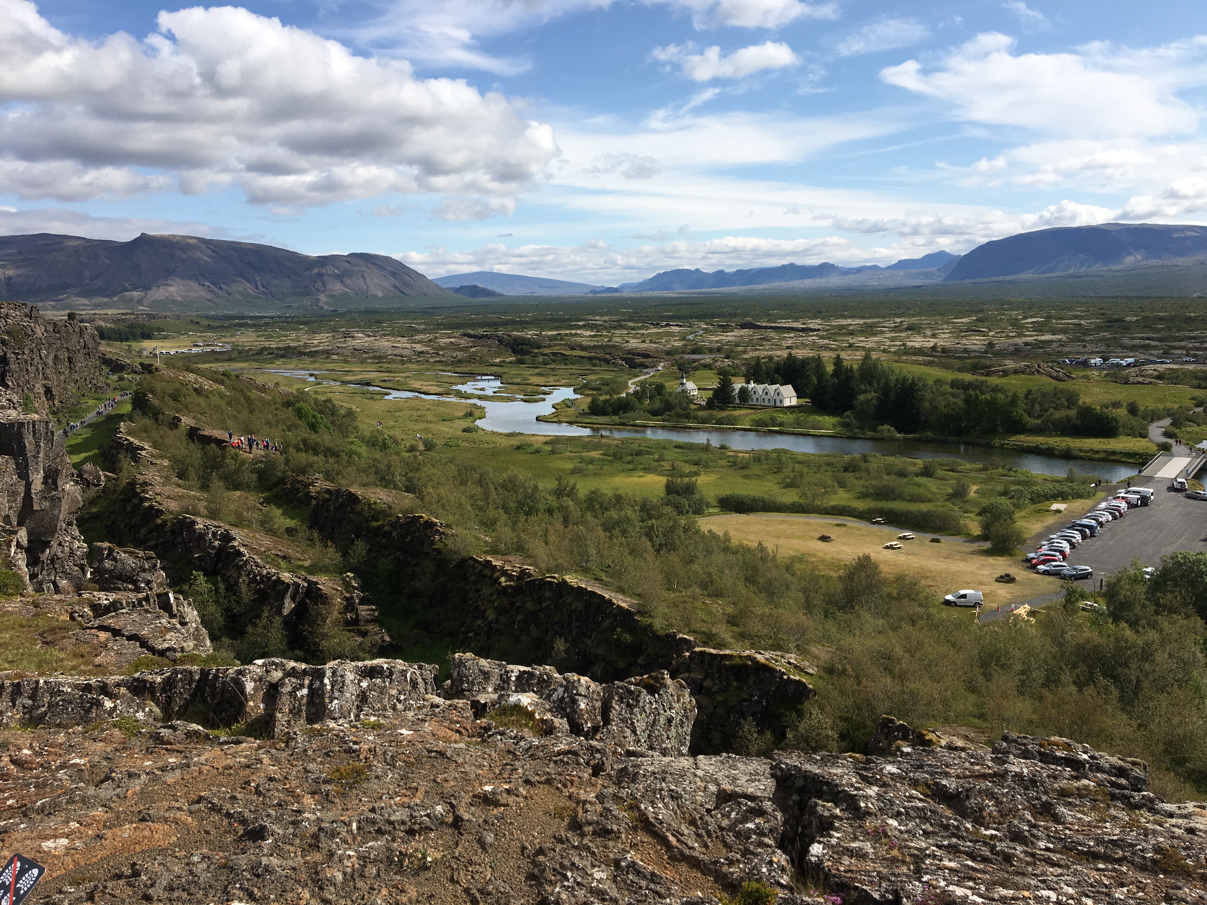
First we went to the lake of pingvallatn. We saw from far away the system of graben with the Mid-Atlantic Ridge plate boundary. This ridge is visible because of the hotspot located under Iceland. The island was formed by magma.
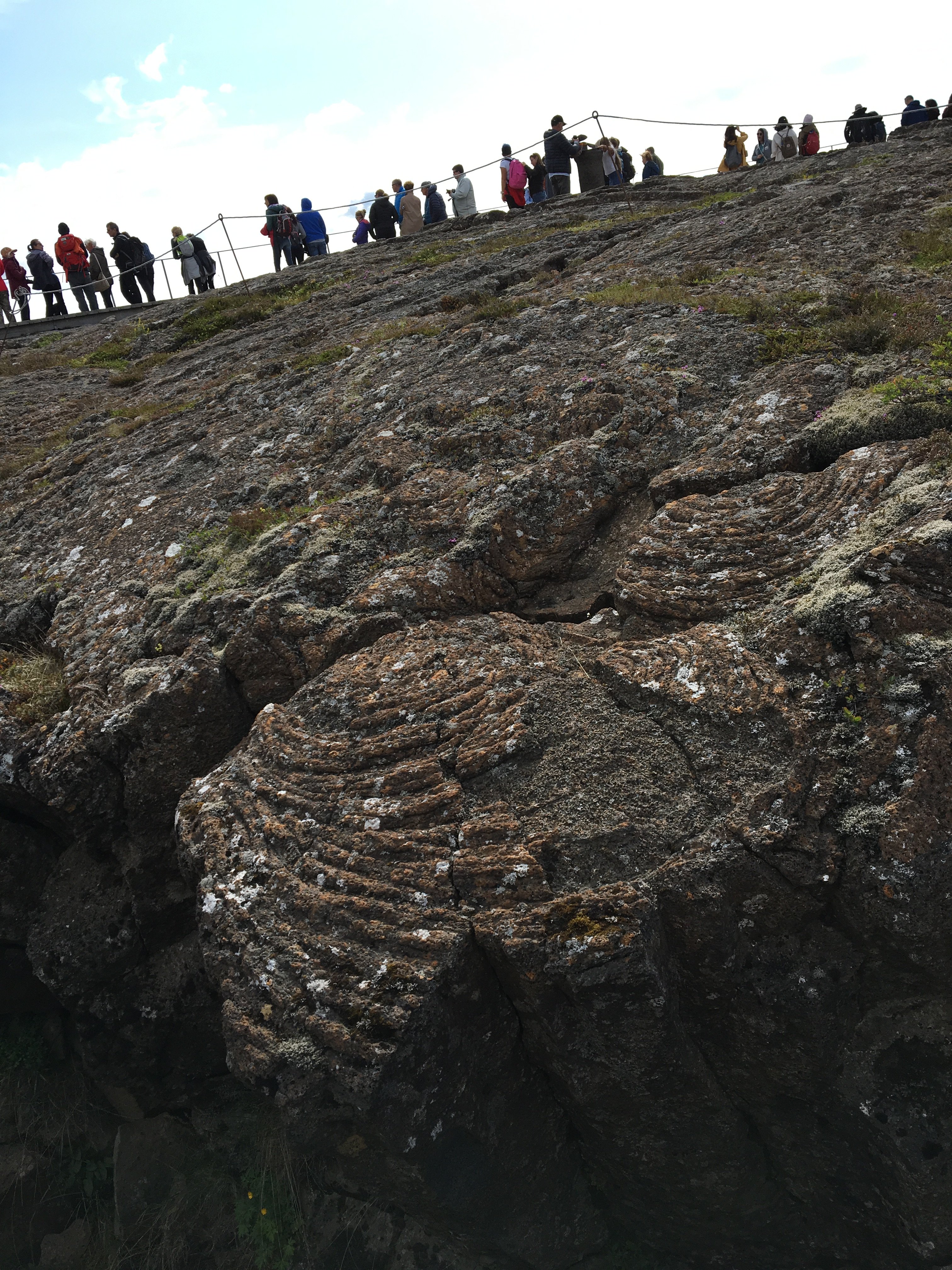
Then we went closer to the ridge, in the National Park of Pingvellir. The lava which is fluid is called pahoehoe. When cooled down, the corresponding rock is called basalt. In these rocks some ripple marks can be found. The graben between the plates is getting wider by approximately 7cm per year.
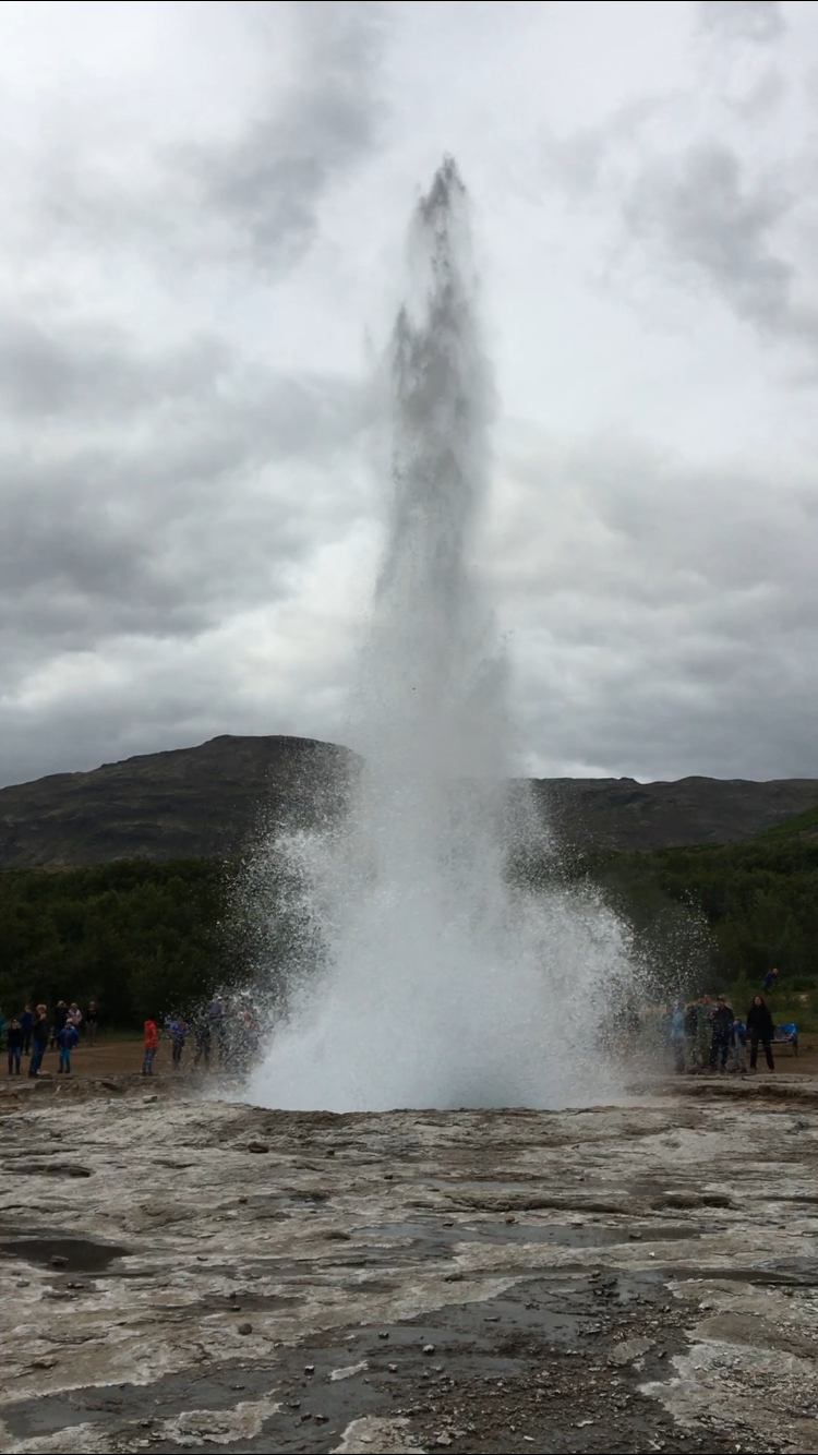
In the afternoon, we went to see geysers. To allow a geyser to be formed, one needs high pressure, a heat source, an underground water source and the system needs to be connected to the surface. The general term geyser comes from the name Geysir, the famous icelandic geyser which stopped working in the 2000th. The duration between each water and steam eruption depends on the geyser. Sometimes it takes a few minutes between two eruptions, sometimes it can take hundred or Or Métal précieux. Dans le cadre du séjour Le TrésOR des MINES nous chercherons de l’or dans le Val d’Anniviers, à la batée. even thousands of years.
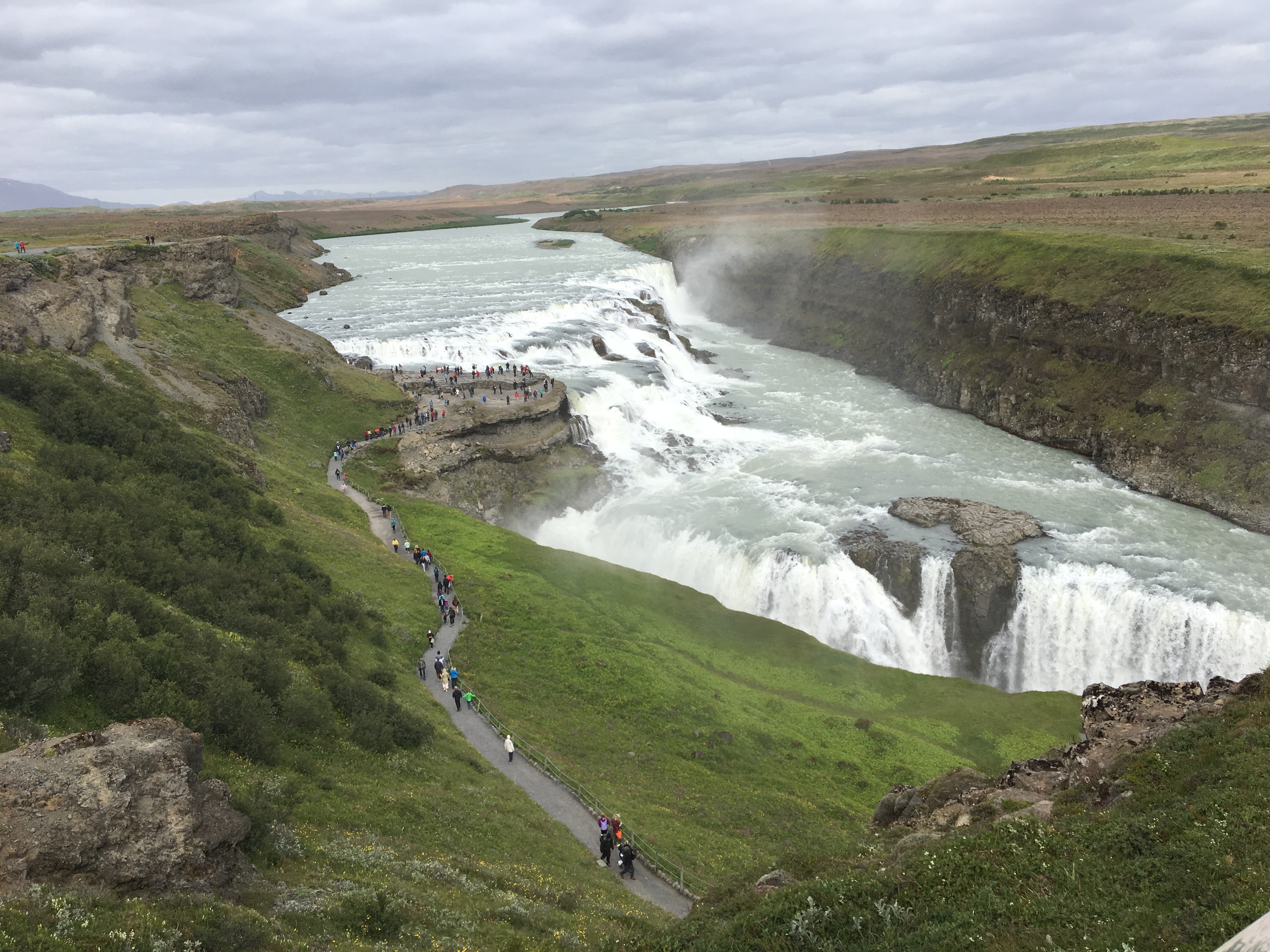
The Gullfoss waterfall has two separate falls. The total height of the fall is 31 meters. The river was formed by great rains after the glaciar age. Basalt rocks are presents on both sides of the river.
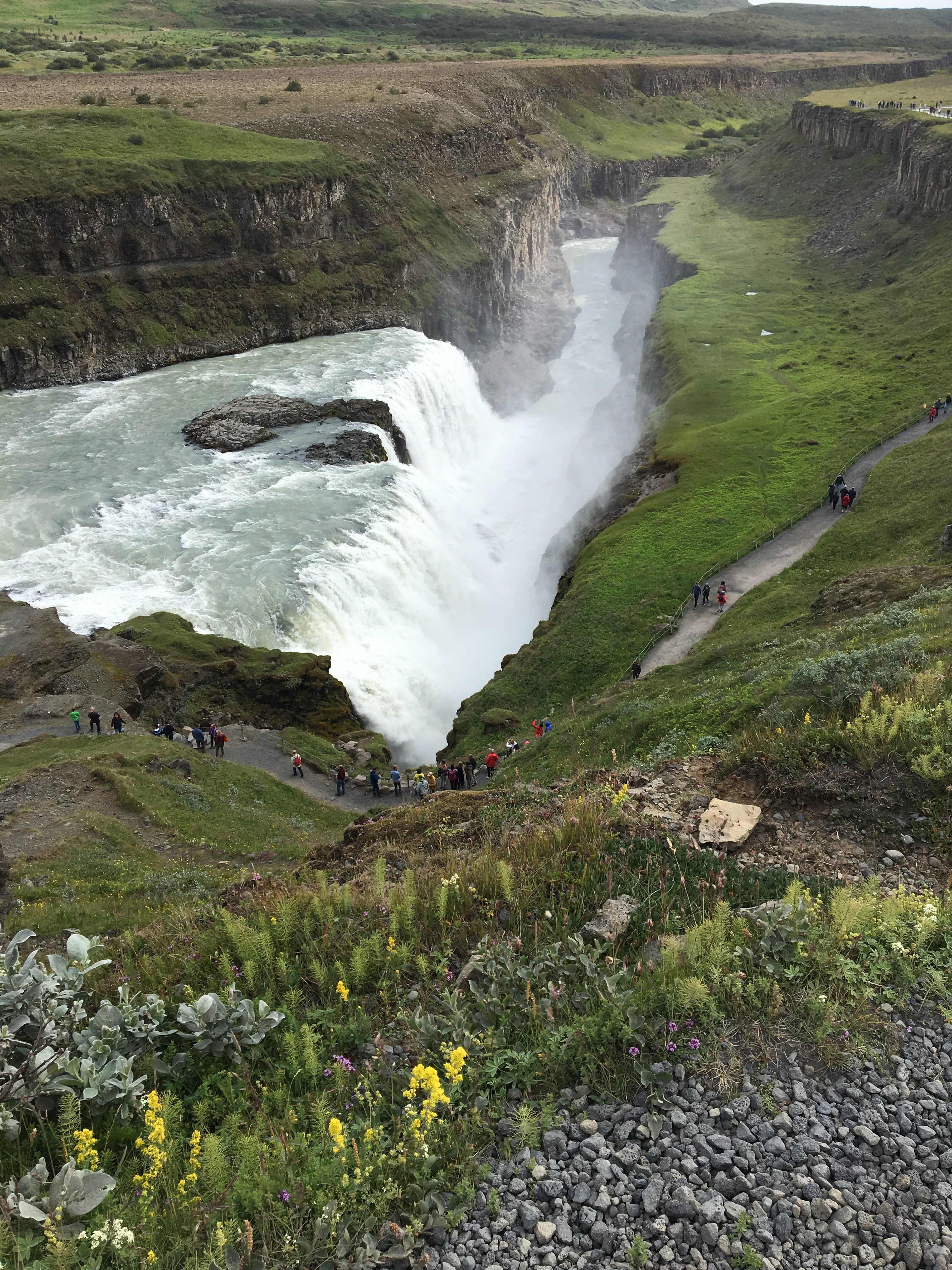
Overall, the golden circle was an incredible experience and the landscape was breathtaking.
Léa, Alexandra, Amaury and Victor
Wednesday, July 10th, 2019
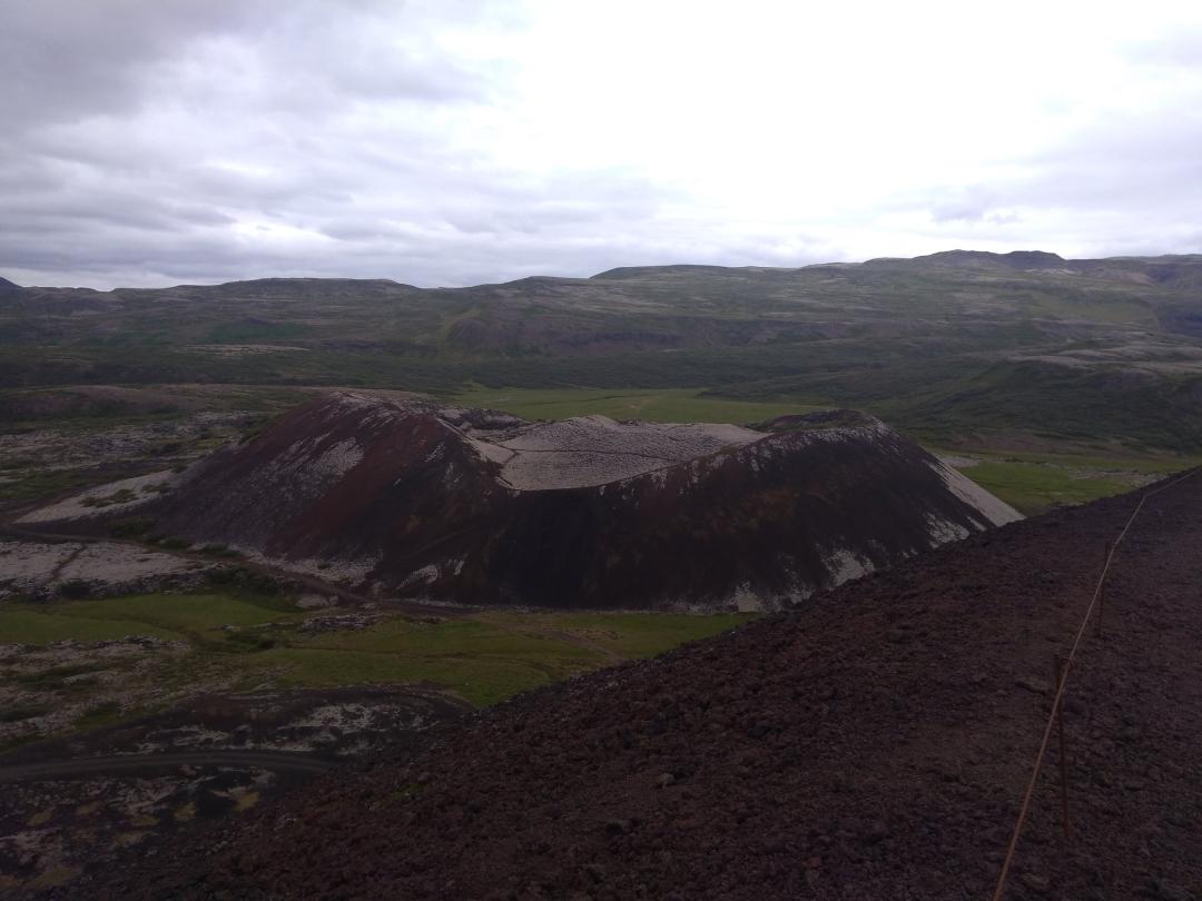
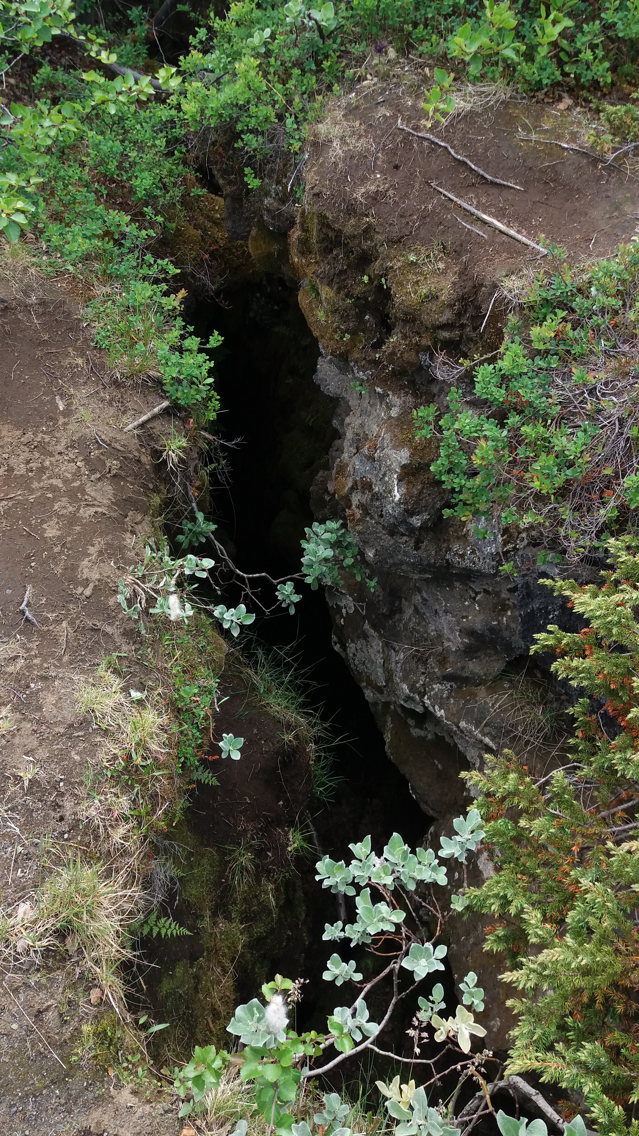
Today we woke up early to take the road, in order to reach Myvatn, in the North-East of Iceland. On our way we stopped at a volcanic zone, where we saw craters made of lava stones (tephras). Those craters were created by an explosive eruption, which happened 3000 years ago. On the walls of the craters were some holes covered by some basalt roof. They are actually lava tunnels formed by lava flowing from the crater during an effusive phase of the eruption. The particular disposition of these craters in line is due to their way of forming : the magma underground accumulates and tries to reach the surface, first erupting by a diffusive way through a fissure. Then the eruption becomes explosive, at some particular places of this fissure, forming those circular craters.
Tonight we are staying at a camping in Varmahlid. Tomorrow we still have a long way before reaching Myvatn.
Ariane, Celia, Chiara and Matteo
Thursday, July 11th, 2019
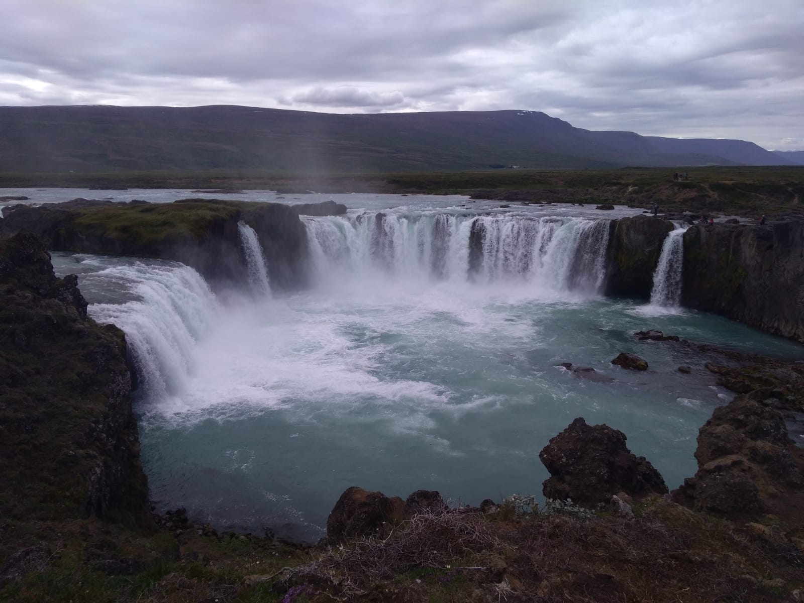
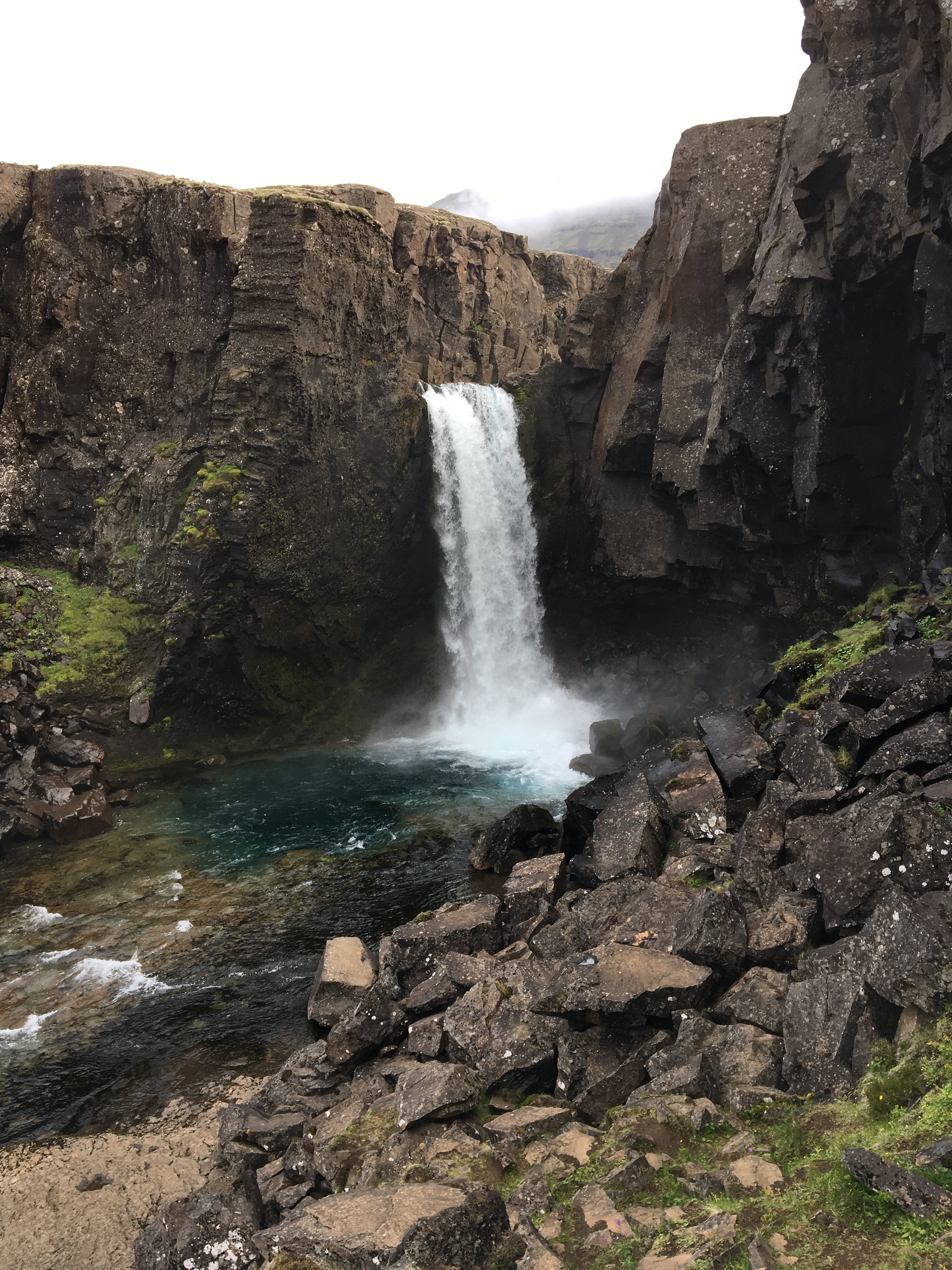
Today, we saw the Godafoss which is a fall of 12 meters high. The water comes from the glacier Vatnajökull. The legend says that near the year 1000, Porgeir, chieftain of Ljósavtn district, accepted Christian faith for Icelanders. He went home and threw his statue of the pagan gods into the waterfall. Godafoss (fall of gods) is said to derive its name from this event. We also saw basaltic columns. A basaltic column is formed by lava which slowly get colder. When the lava is colder it takes a smaller volume, and some fissures appear. Then, the solid lava is broken and some vertical basaltic columns are created.
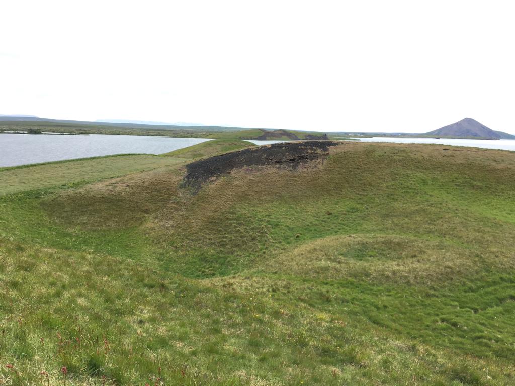
Then we stopped at Skutustadagigar where we saw a lot of pseudo-craters, rare geological formations created through the interaction of lava and water. Indeed there was a shallow lake before, and lava covered it. Because of pressure and heat, some steam explosions began, and it created those rootless (it doesn’t come from a deep magmatic chamber) craters.
Tonight we sleep at Vogar for 5 nights. We set the camp up.
Mathieu, Aurèle and Gaspard
Friday, July 12th, 2019
We began the day by walking along a trail that finished on the top of Vindbelgiarfjall which was made of basalts. The view on the top was astonishing.
Then, we went to hverfell to observe a lava field and a crater.
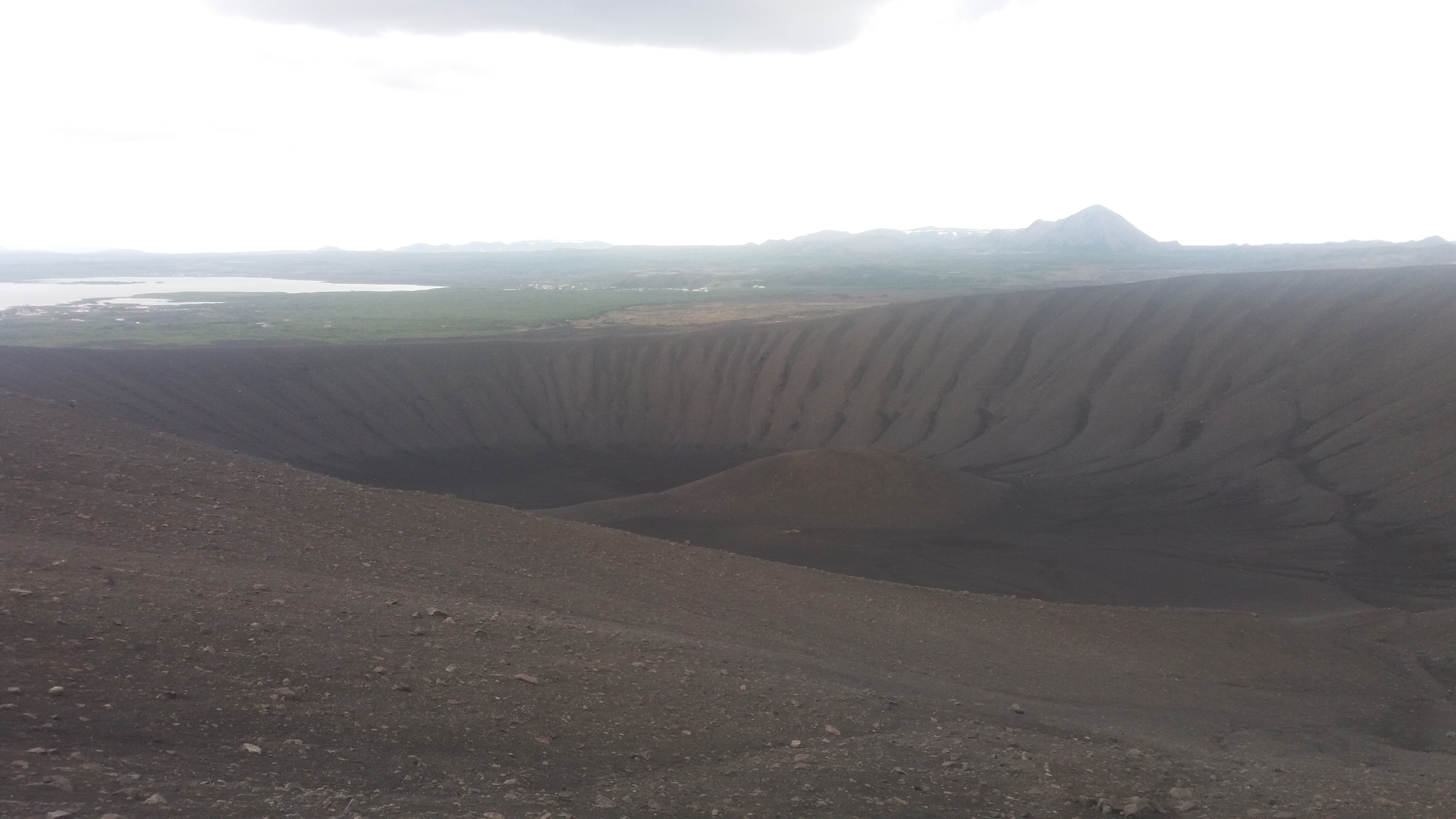
In this lava field ,we saw some lava trails ; funnels, holes and ripple marks. This lava field was created by diffusing lava trails which came from eruptive fissure. However , the crater was created by explosive eruptions. We learnt that the two parallels faults are connecting together by transforming faults.
Alexandra, Amaury, Léa, Victor
Saturday, July 13th, 2019
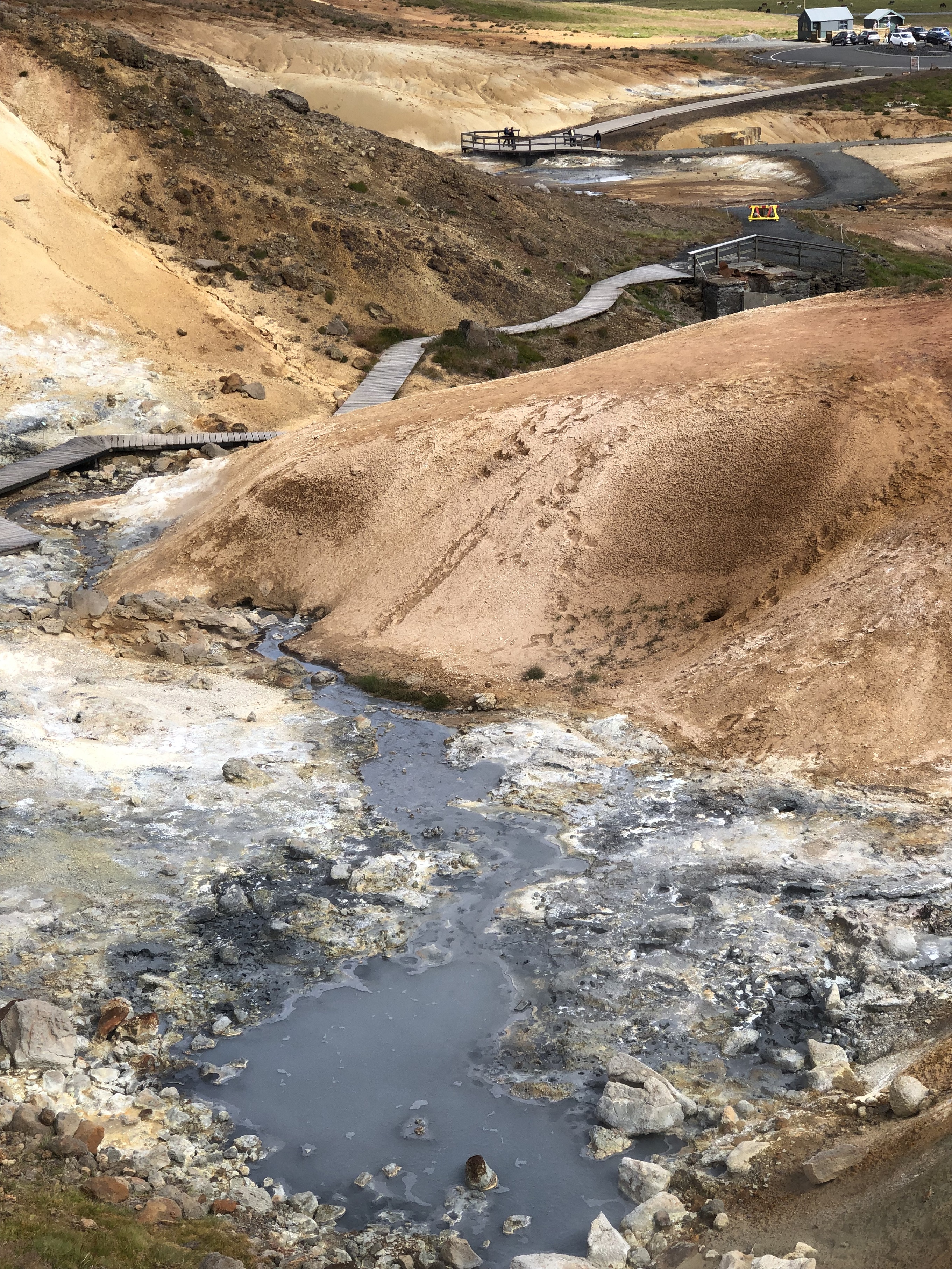
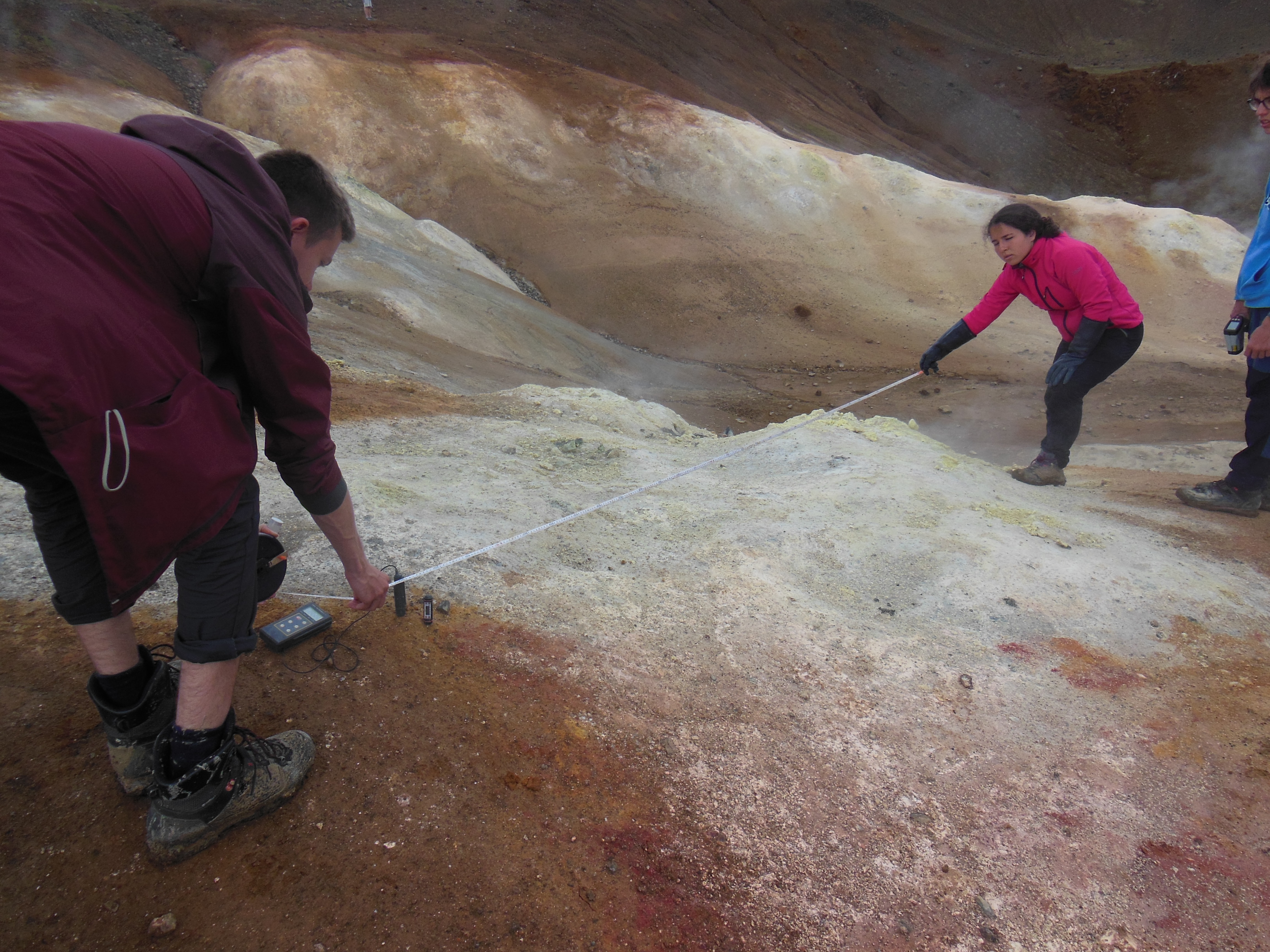
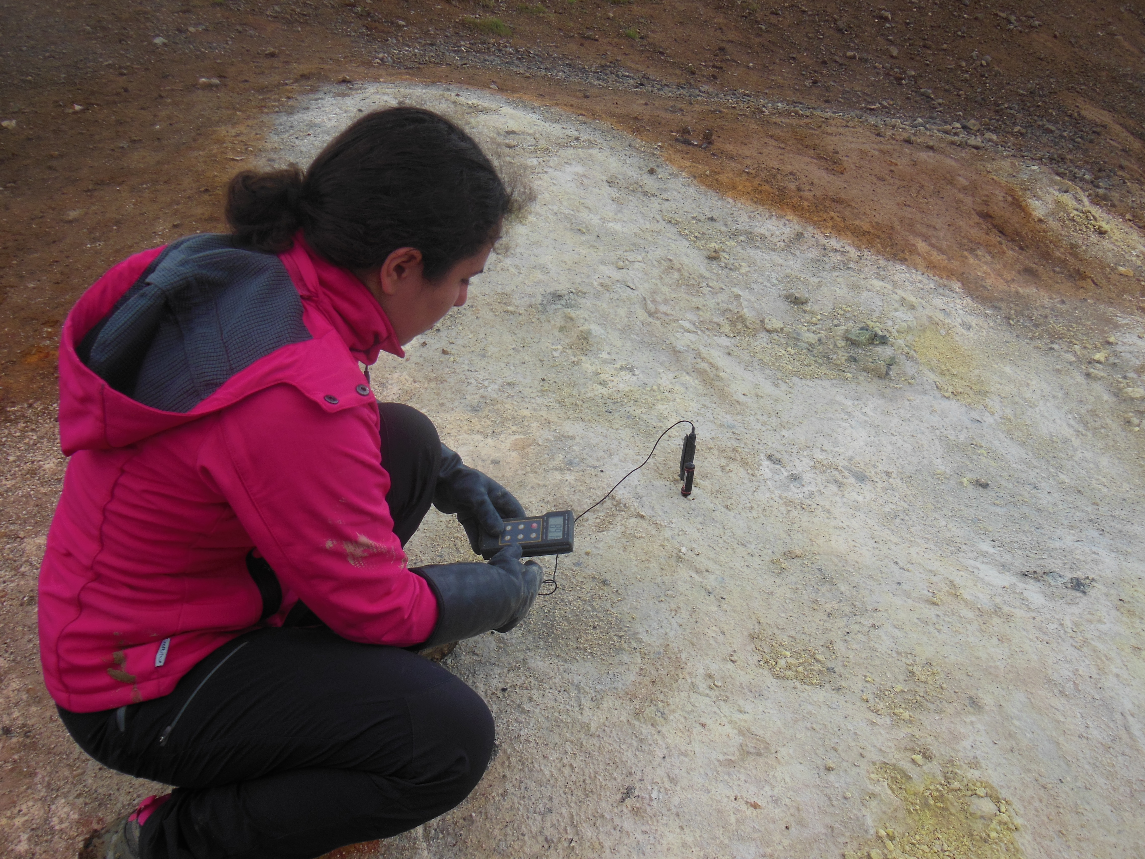
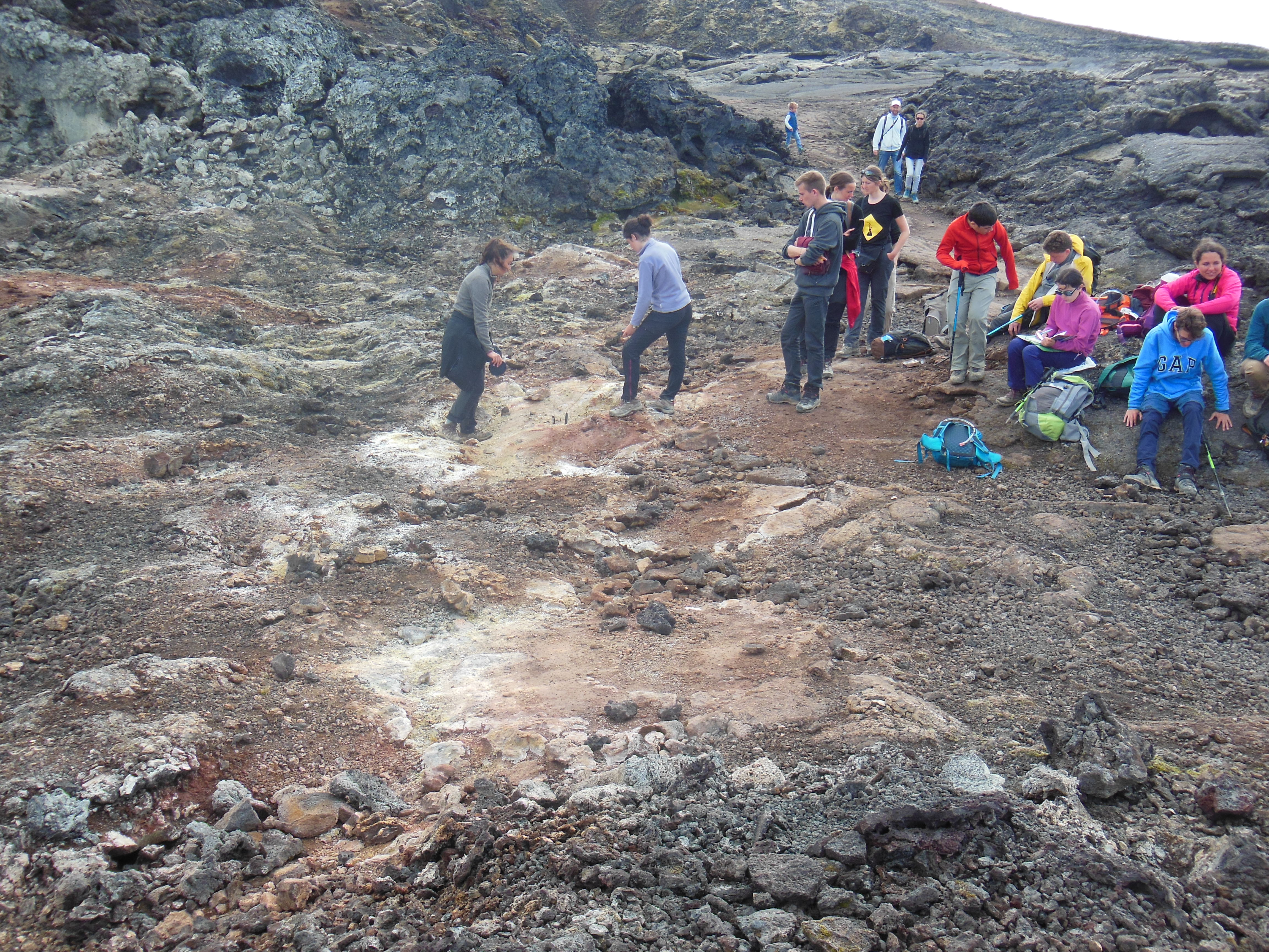
Today, we went to a geothermal site next to the campsite of Reykjahlid (GPS details : N65°38.445’ W16° 48.505’). At this site, we saw several fumaroles and bubbling baths. There, the rock was yellow (because of the presence of rhyolite), beige, and other tons of red or
Or
Métal précieux. Dans le cadre du séjour Le TrésOR des MINES nous chercherons de l’or dans le Val d’Anniviers, à la batée.
purple (due to other minerals and molecules). We tried our best to find the finest crystals and minerals on our way on the ridge (gypsum for instance) ; we also measured the heat of the fumaroles thanks to probes and IR thermometers at various places, on different positions on the fumaroles.
We went to the supermarket, to buy the necessary and healthy food for the next days.
Then, we walked a few kilometres to see a beautiful fault. We also measured the temperature of an underground hot source, which is situated below the fault, named Grjόtagjá.
Alexandra, Chiara, Ariane and Gaspard
Sunday, July 14th, 2019
Today we walked around Stora Viti crater in the Krafla volcanic system, where we had an astonishing sight on the lake inside the crater. Then we measured the temperature of a fumarole, both inside the ground and on the surface, with the same procedure followed yesterday. We ate lunch on the top of the Krafla mountain, then we went to Leirhnjukur geothermal area and the nearby lava field with basalts and rhyolite (the Krafla fires), and we measured the temperature of another fumarole.
We visited the Krafla geothermal power plant, and we learnt that the central generates 30 MW with only the ground heat.
We finished the day by walking around the Myvatn lake.
Amaury, Célia, Victor
Monday, July 15th, 2019
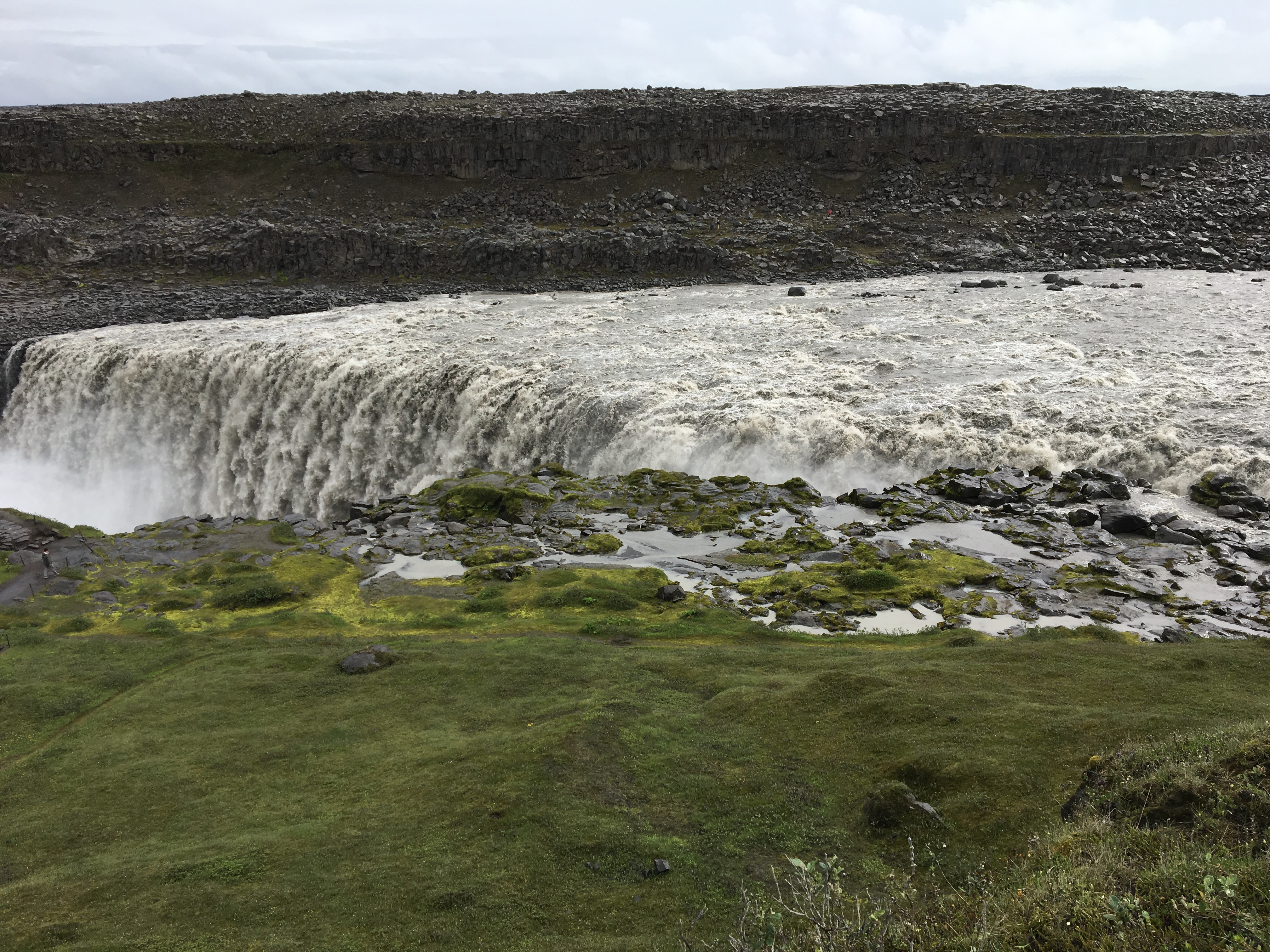
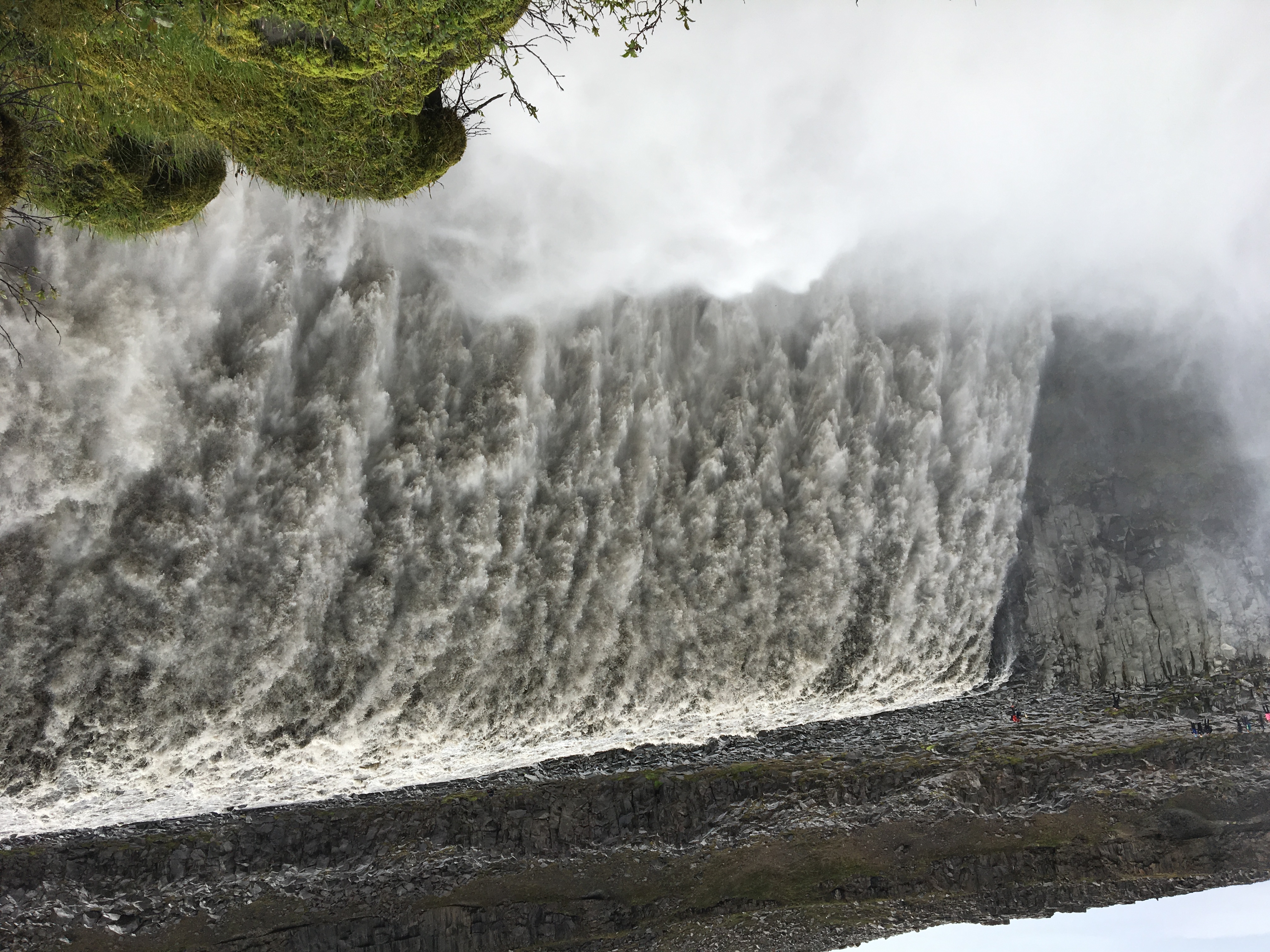
Today we woke up early in order to pack our tent up. After 1 hour of travelling, we stopped to Dettifoss located in Vatnajökulspjodgardur national park. This waterfall has the biggest flow of the entire country. We continued the road and saw other falls such as one which is located very near of the camping in Fossardalur, where we saw a lot of clouds.
Aurèle, Léa, Matteo
Tuesday, July 16th, 2019
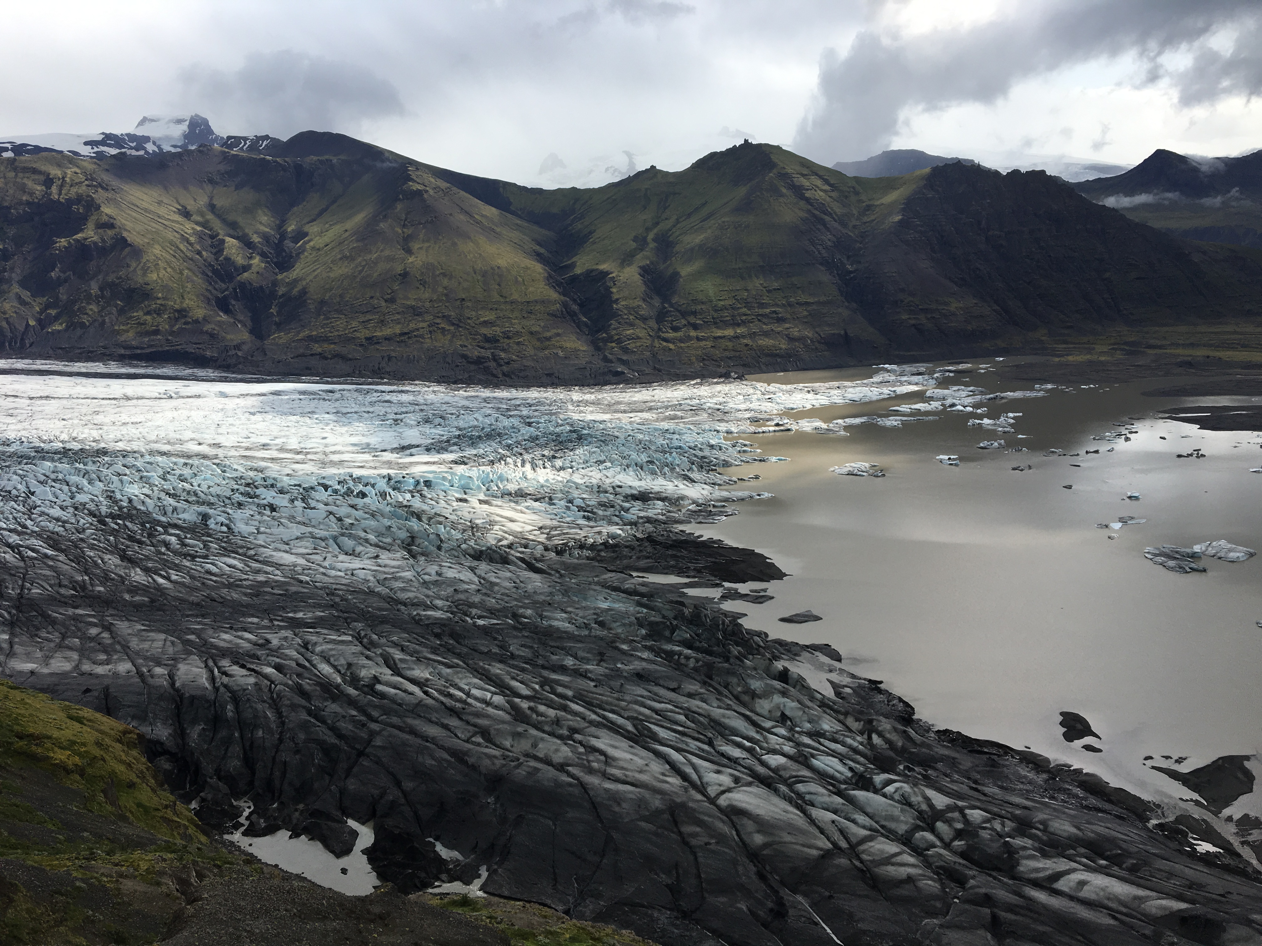
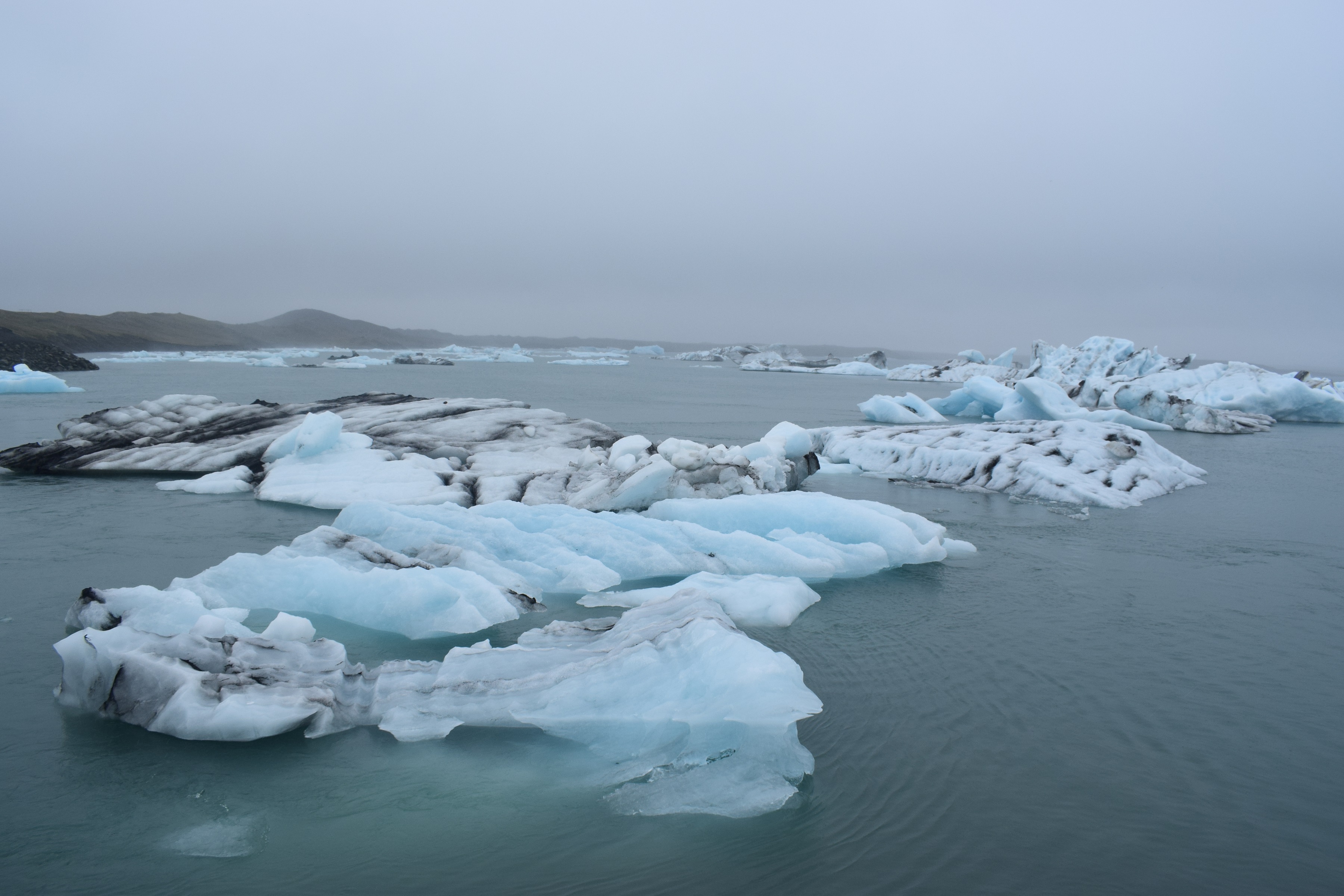
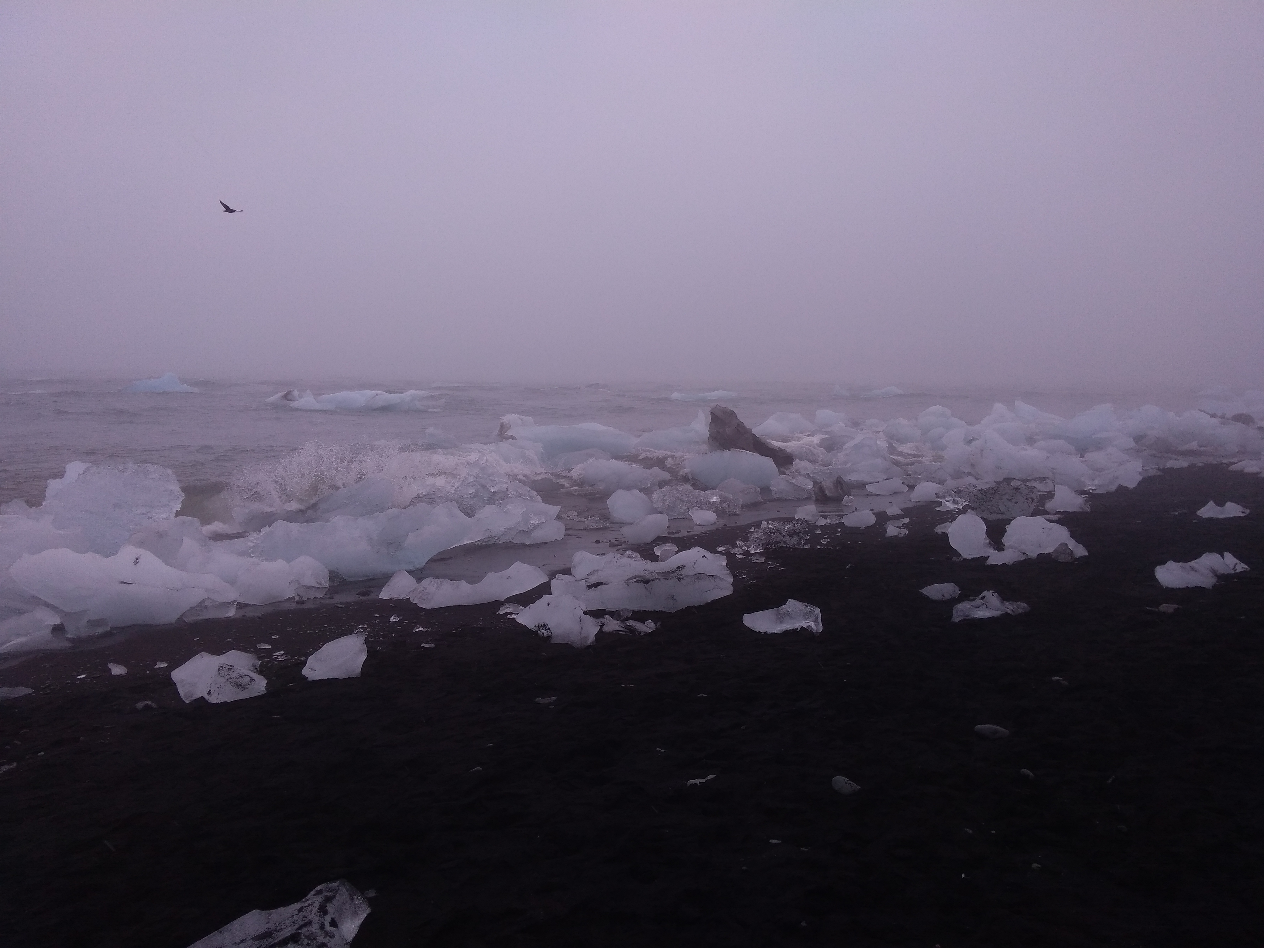
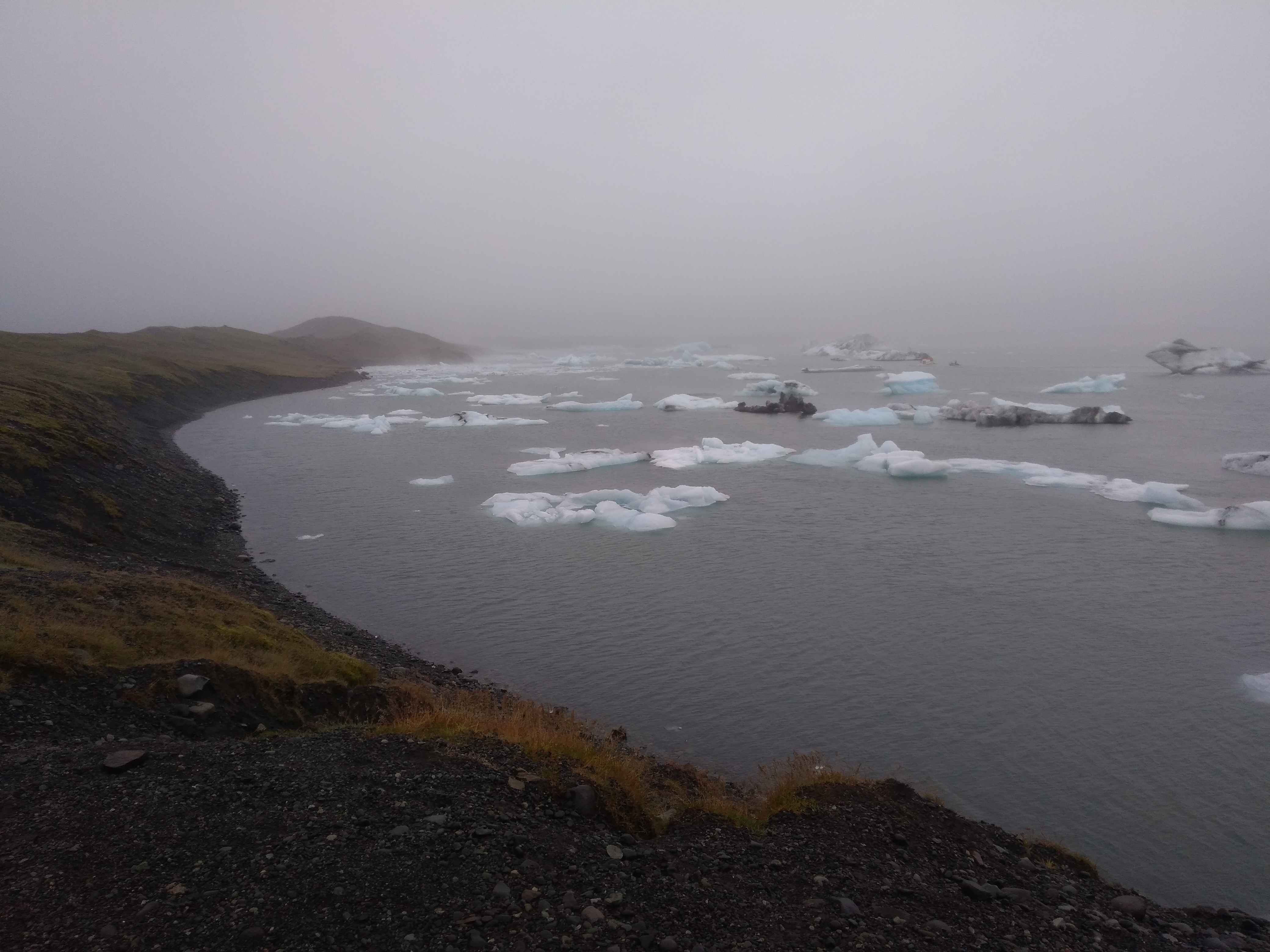
Today, we packed our things to drive to Svinafell in the South East (near the great glacier of Vatnajökull). On our way, we laughed a lot and slept, and went to a supermarket to buy the healthy food we needed urgently. Then, we stopped at Jökulsárlón to see the glacial lake surrounding partially Vatnajökull. There were huge icebergs floating and we were amazed, although we deplored that the weather didn’t allow us to see the glacier, laying in the fog. Some lucky fellows even managed to see a seal, and other rather bold ones also ran into the ocean to touch an ice block (let’s keep this between us).
Finally, we reached the beautiful campsite of Svinafell, located between mountains and the glacier.
THE END.
Bonus : What’s the difference between an iceberg and a clothes brush ?
- One crushes boats and the other brushes coats ! (huhuhu)
Chiara Gaspard Ariane et Alexandra
Wednesday, July 17th, 2019
Amaury :
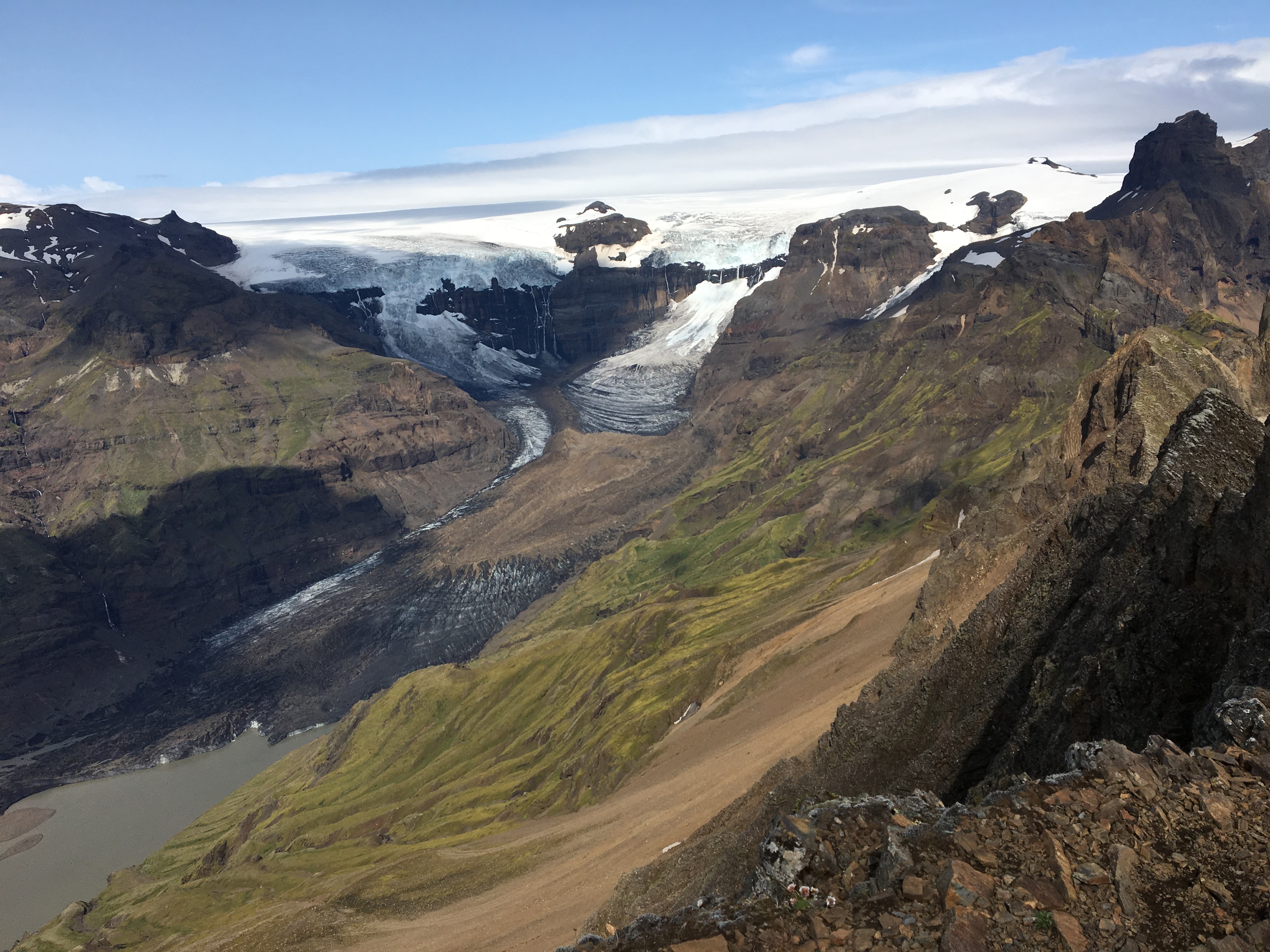
Today we went hiking during the entire day in the Skaftafell National Park. As we did our trip we saw the glacier Skaftafellsjokull, and we took some scientific pictures. Indeed, for around 10 years OSI took pictures of the glacier from the exact same spot that we did. There was actually a rock engraved with OSI that we used to stand on when we took pictures of the glacier.

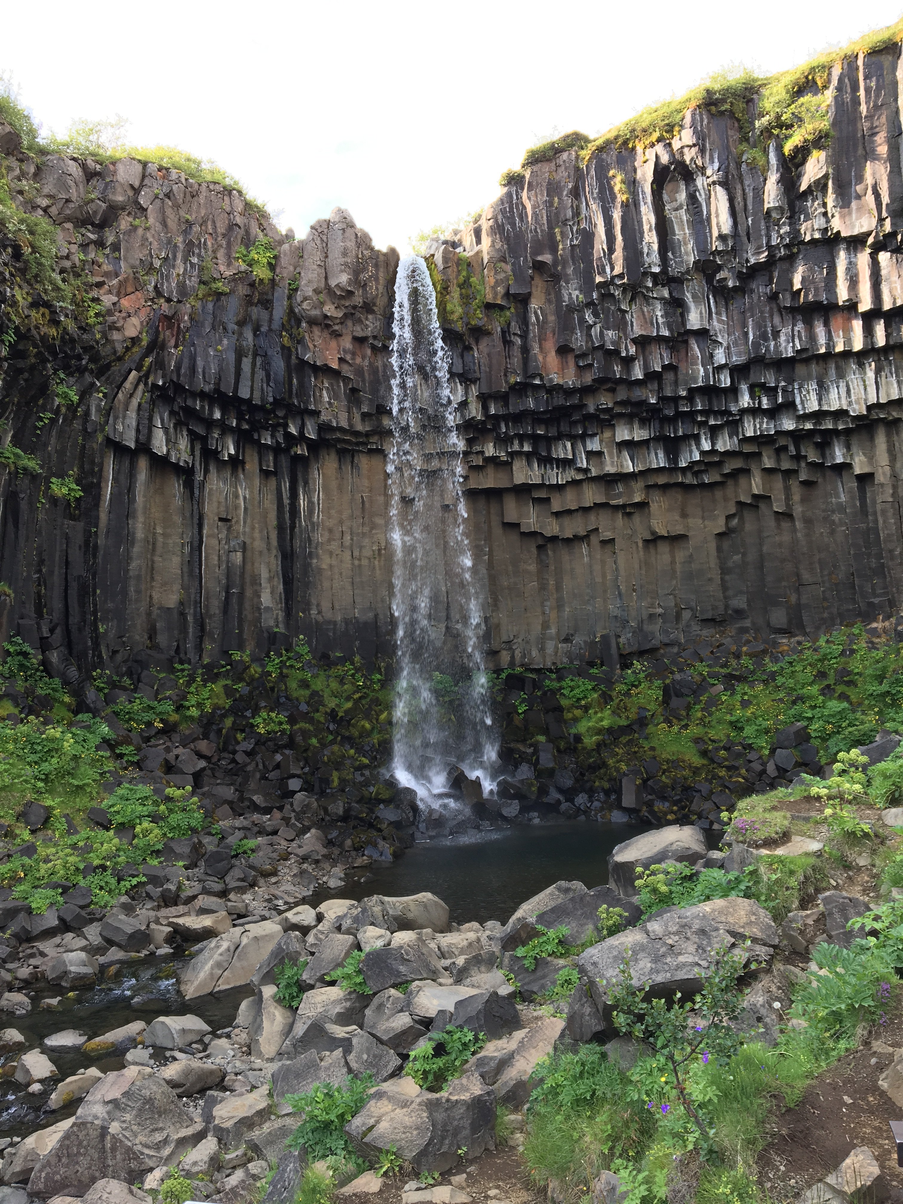
These pictures will be used as a mean of measurement to see the time evolution of the glacier, that can be due to different reasons (for example global warming). We also saw the lateral moraine which separates two valley glaciers. We also saw columned joined basalt which were perfectly formed (a perfect hexagonal shape), we saw them at Svartifoss which is a waterfall. We also saw a couple of other waterfalls however they were not as stunning as Svartifoss was.
Célia :
The group separated in two and some climbed on the top of the mountain Kristinartindar at 1100 m, where we had an astonishing sight of the glacier and its moraines. It was great and the view was breathtaking.
Thursday, July 18th, 2019
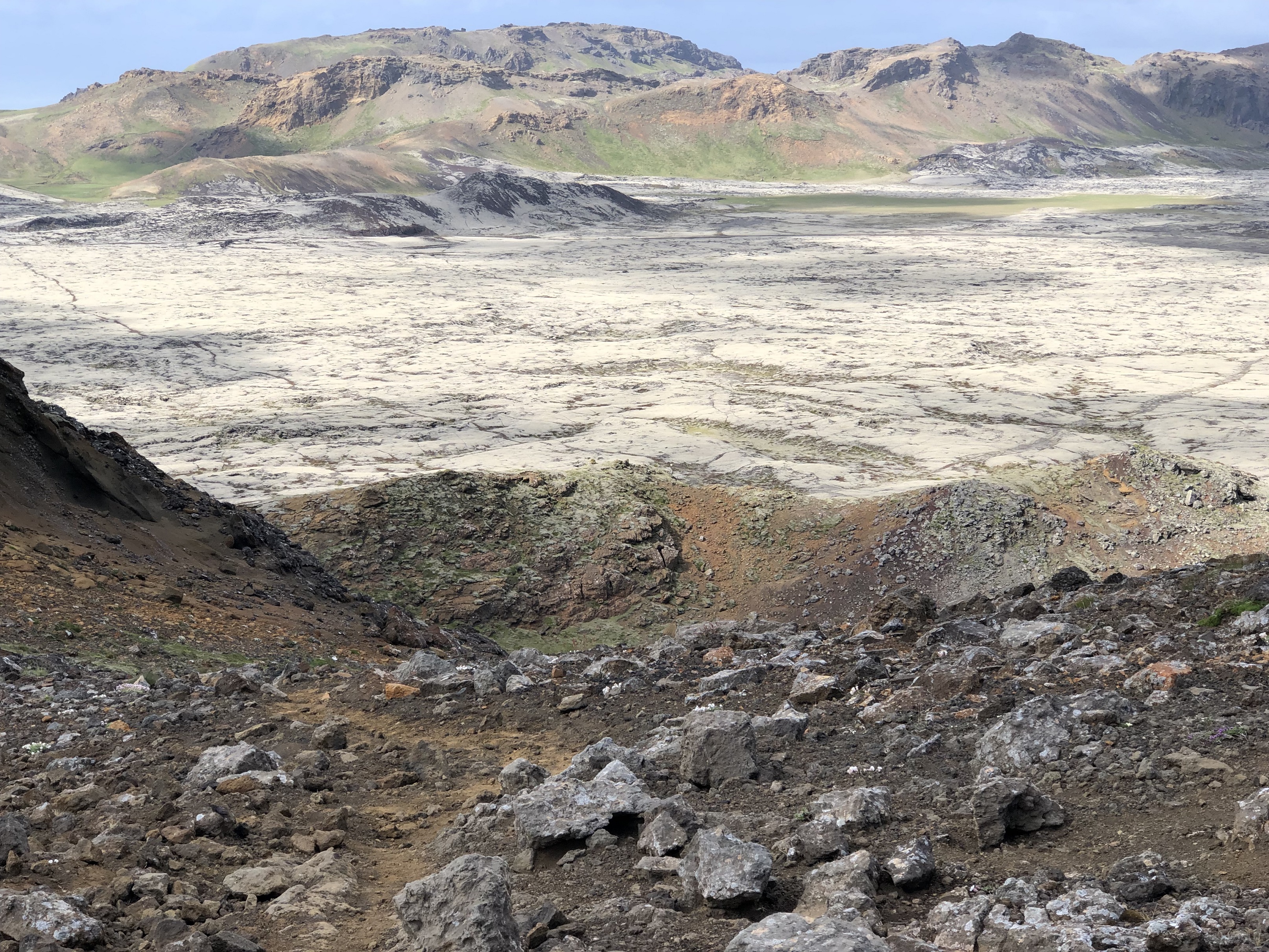
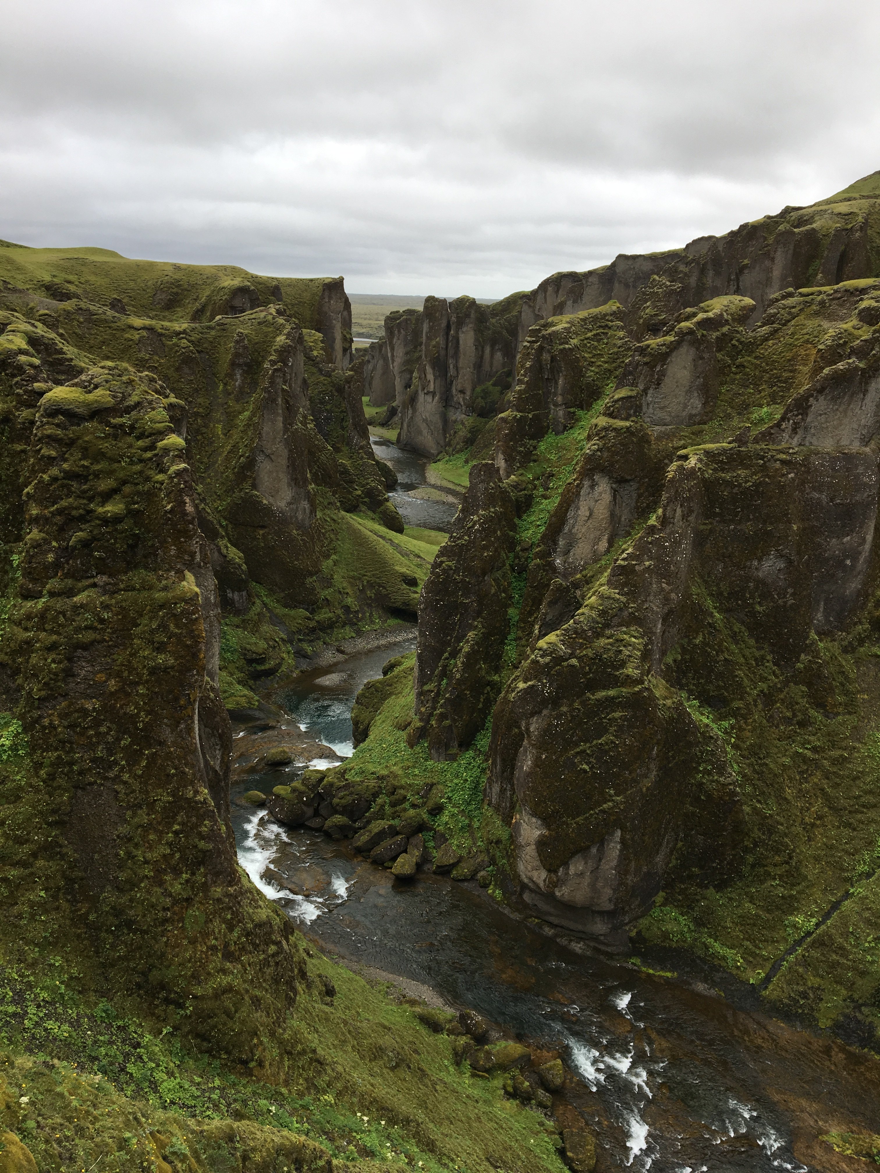
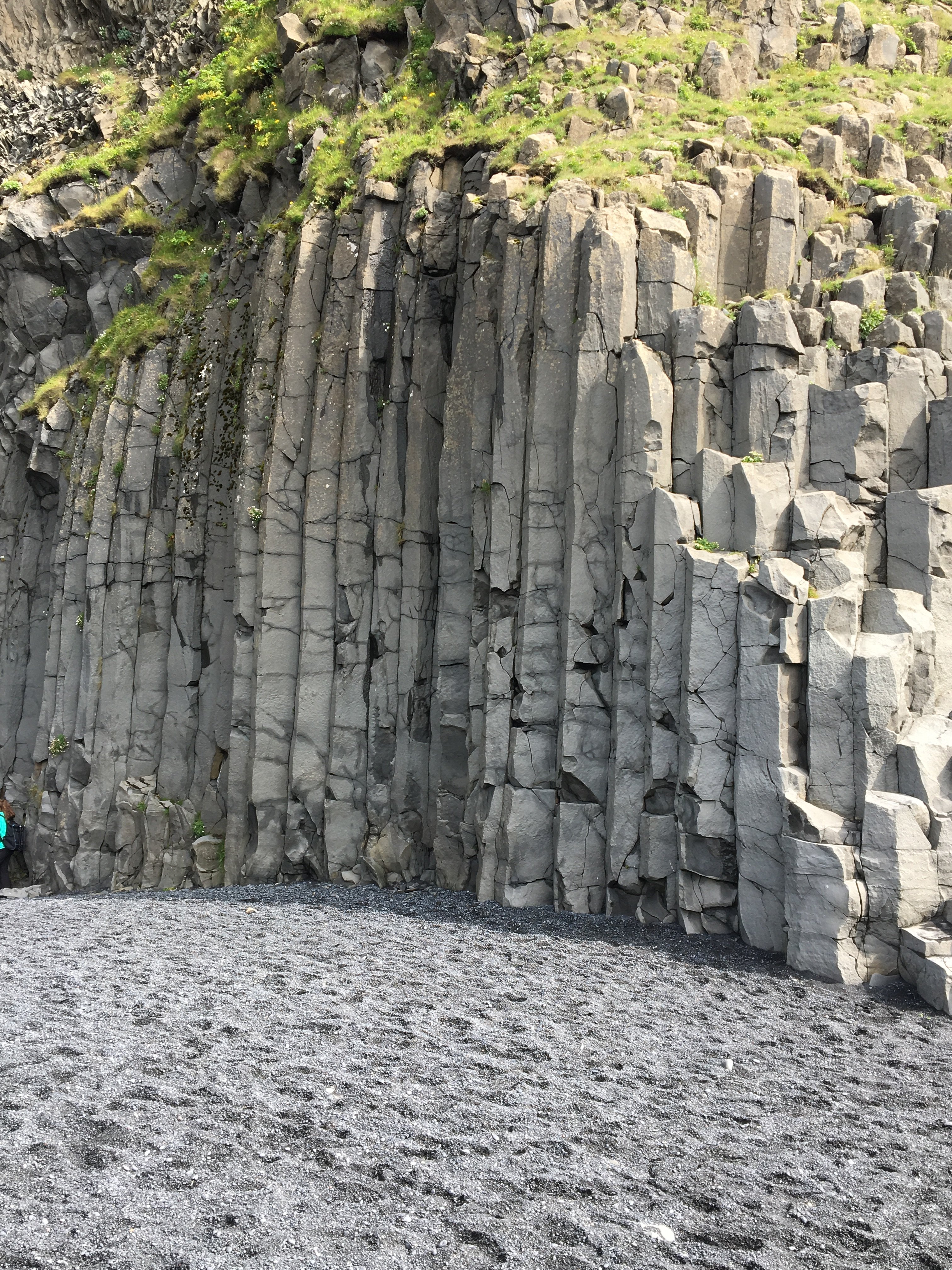
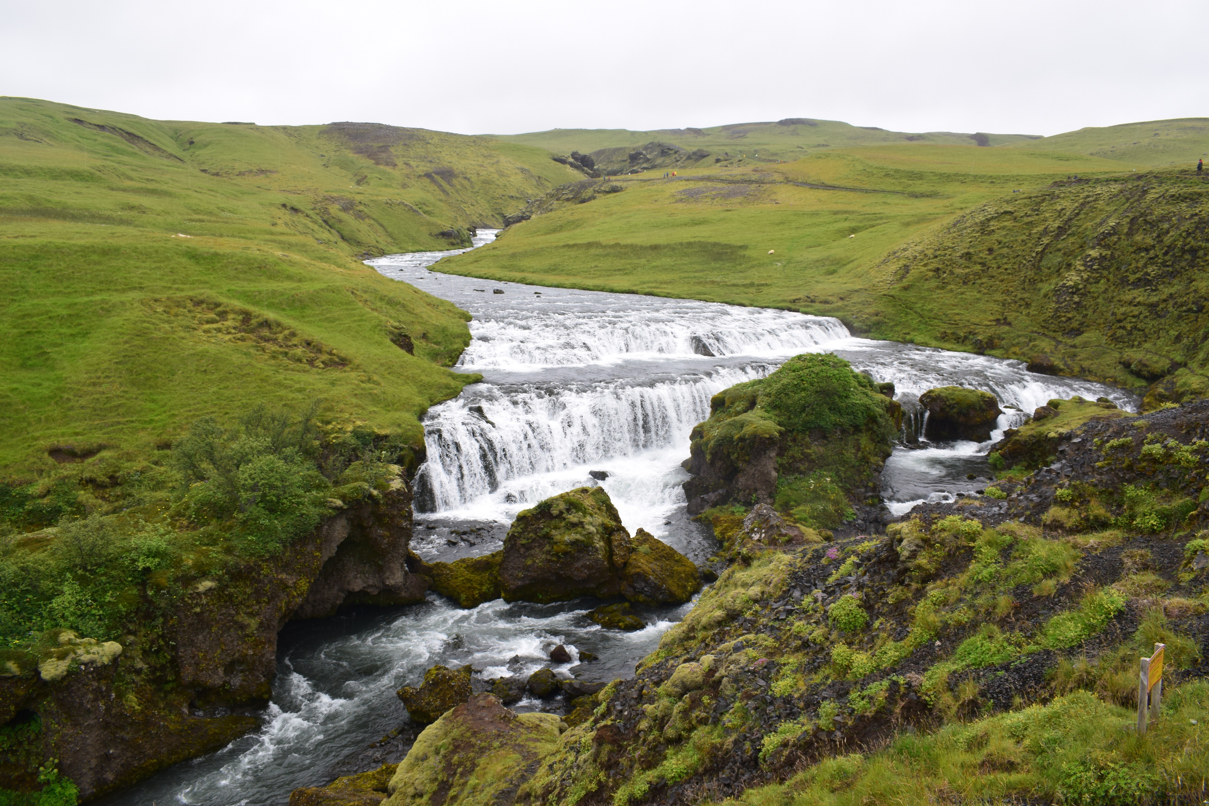
Today we left the camping located near the Skaftafellsjokull glacier to go to a camping in Vik. On the road we made different stops such as the Fjadràrgljufur canyon which is about one hundred metres deep and a little over one kilometre long. This canyon is believed to be formed during the end of the last ice age around nine thousand years ago. We also stopped to the Katla Geopark and saw a big lava field with a lot of moss. The Laki had an eruption and it caused many hardships, for example it forced the Icelanders to move to other countries. The other consequences of the Laki eruption are probably the hunger and crops failure which caused the French revolution. When we arrived at the camping, we went to a beach and saw basaltic columns. After this short walk the group was split in two and one part of the group made a walk on a black sand beach and the other went to a mountain to have a nice view of the valley.
Aurèle, Léa, Matteo

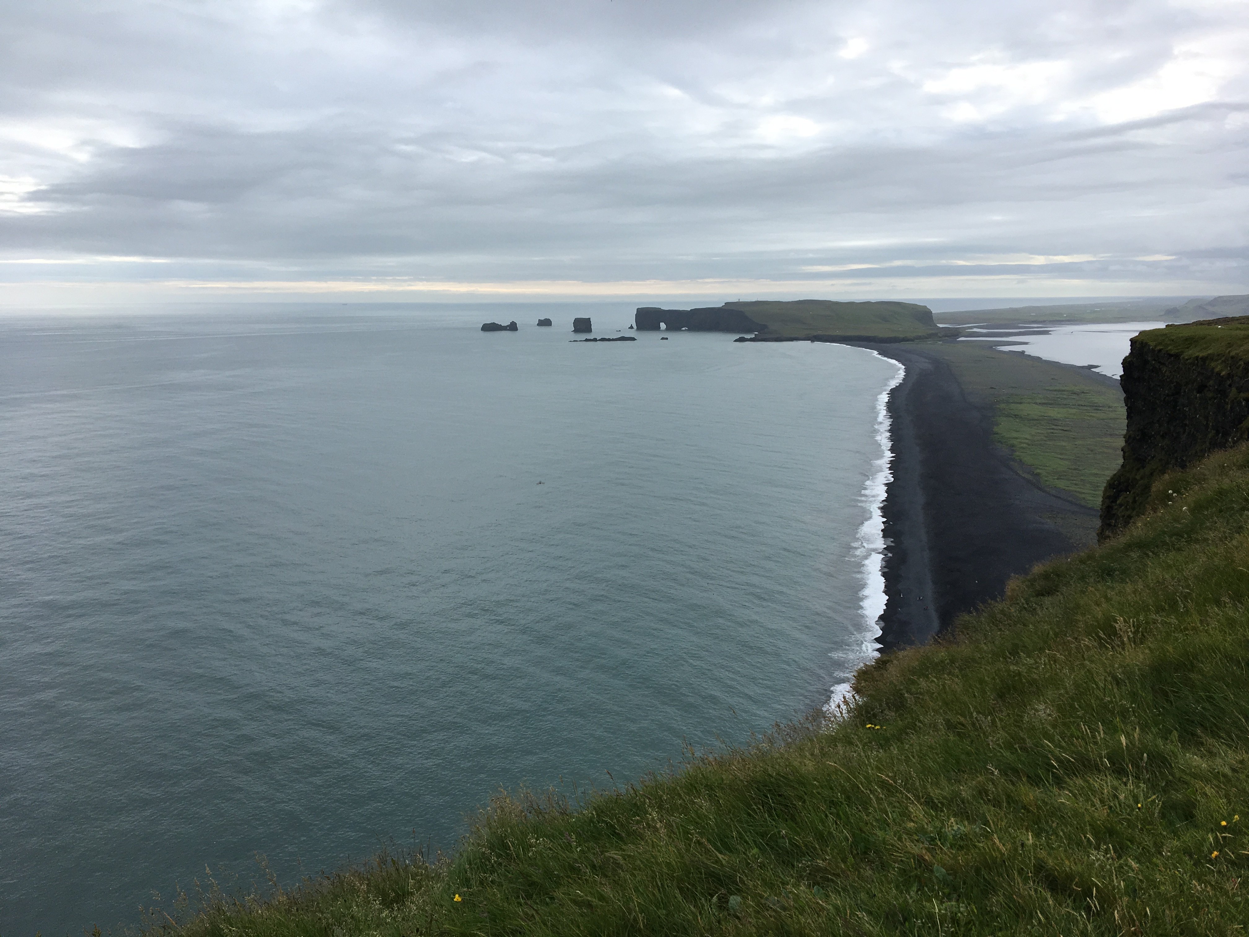
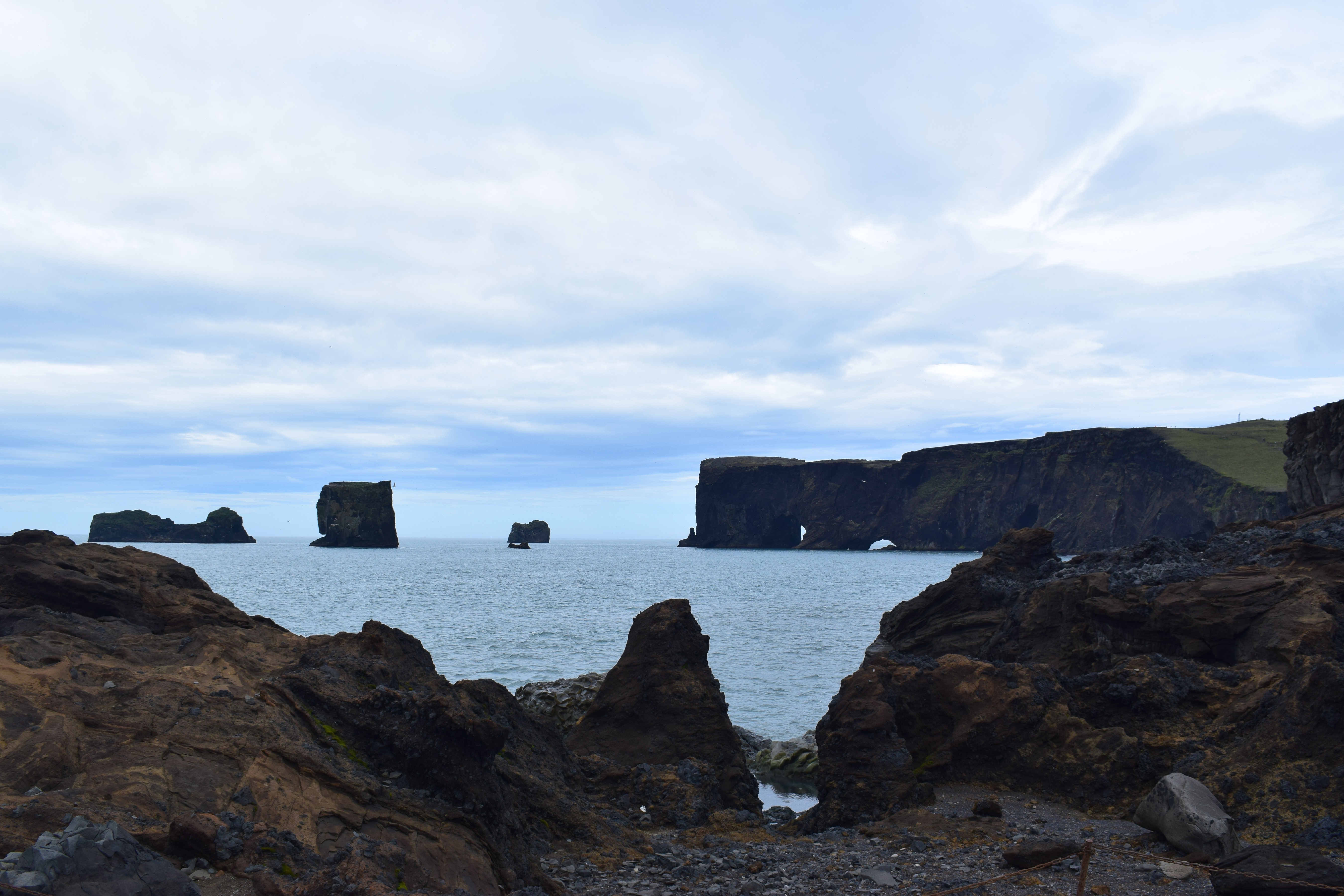
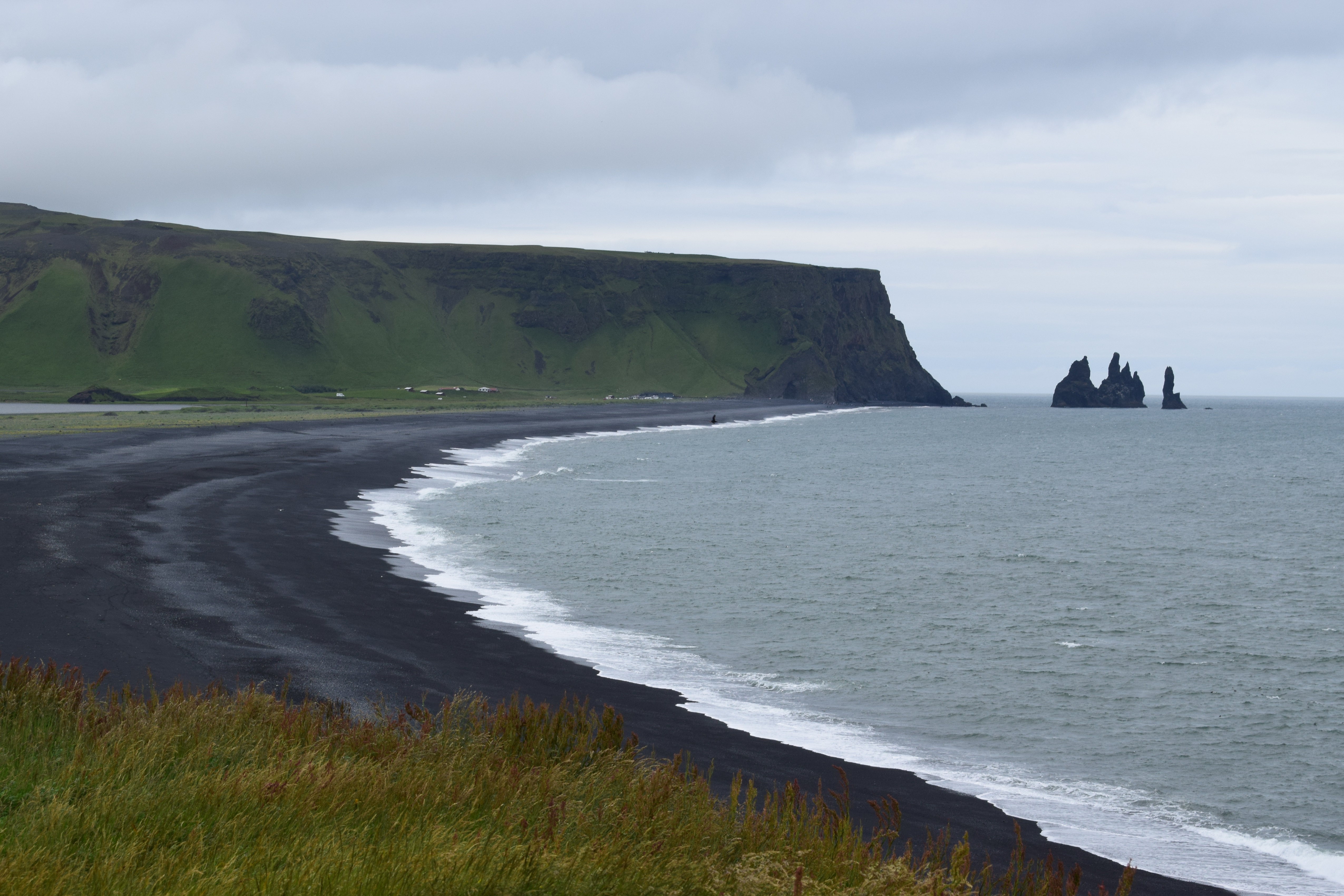
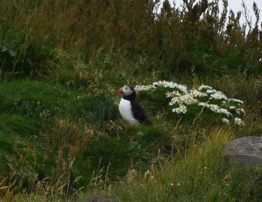
Friday, July 19th, 2019
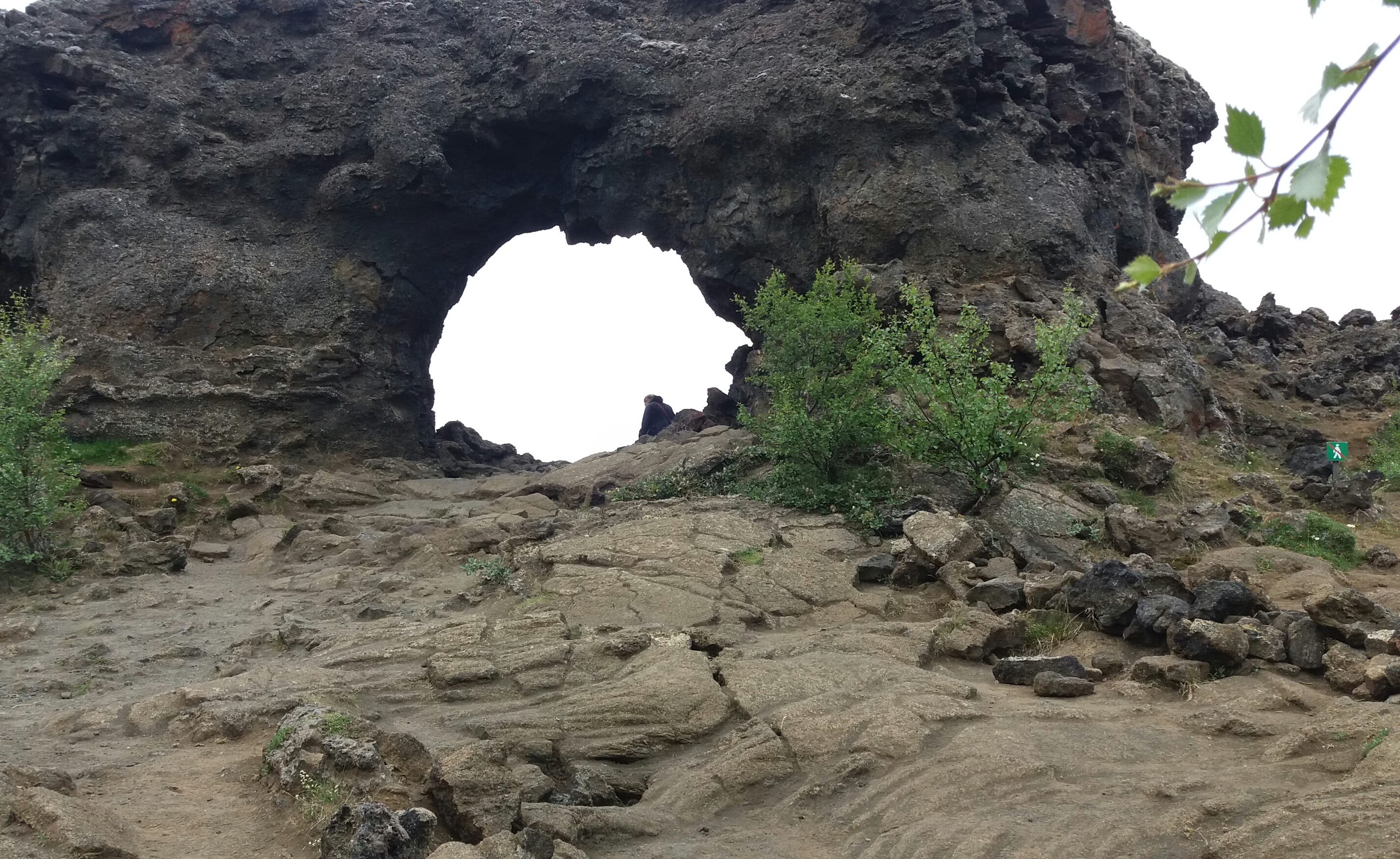
Today, we left the campsite of Vík to drive to Hveragerði. On our way, we saw a few interesting places. First of all, we stopped at the cliff of Tó, which represents the southern point of Iceland. We were able to see a beautiful landscape and also some local birds, such as puffins. This place used to be an island, but because of sedimentation and volcanic eruptions, it became linked to mainland. The island was formed by a submarine volcano. We noticed hyaloclastite (a sort of rock, which got modified by lava) and arches, which were altered and eroded by ocean waves. Bit by bit, erosion will lead to the separation of parts of the cliff, dividing them in columns rising alone from the ocean.
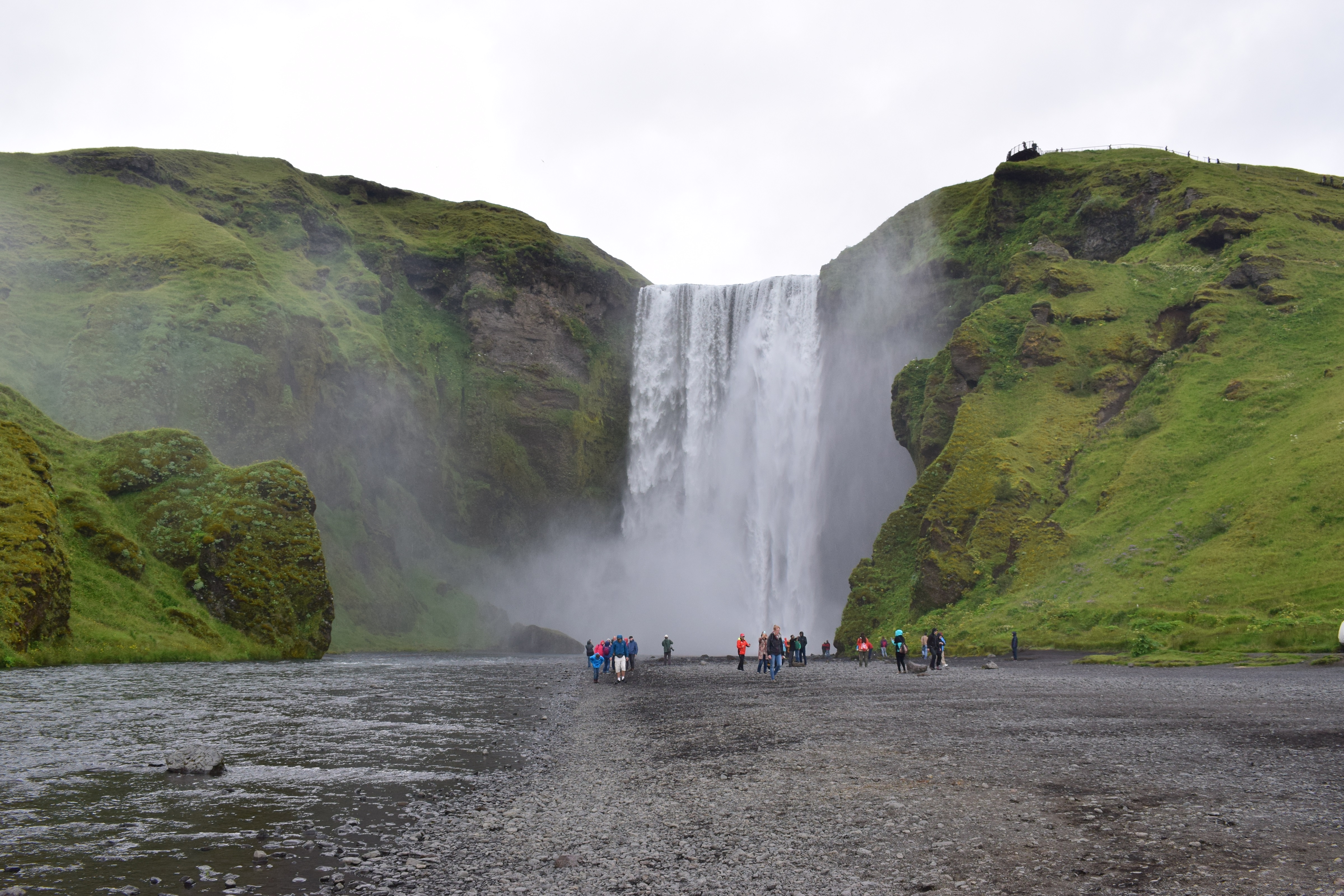
Then, we walked along the canyon of the waterfall of Skógafoss (well-known, and appearing in TV shows such as Vikings), where we had lunch.
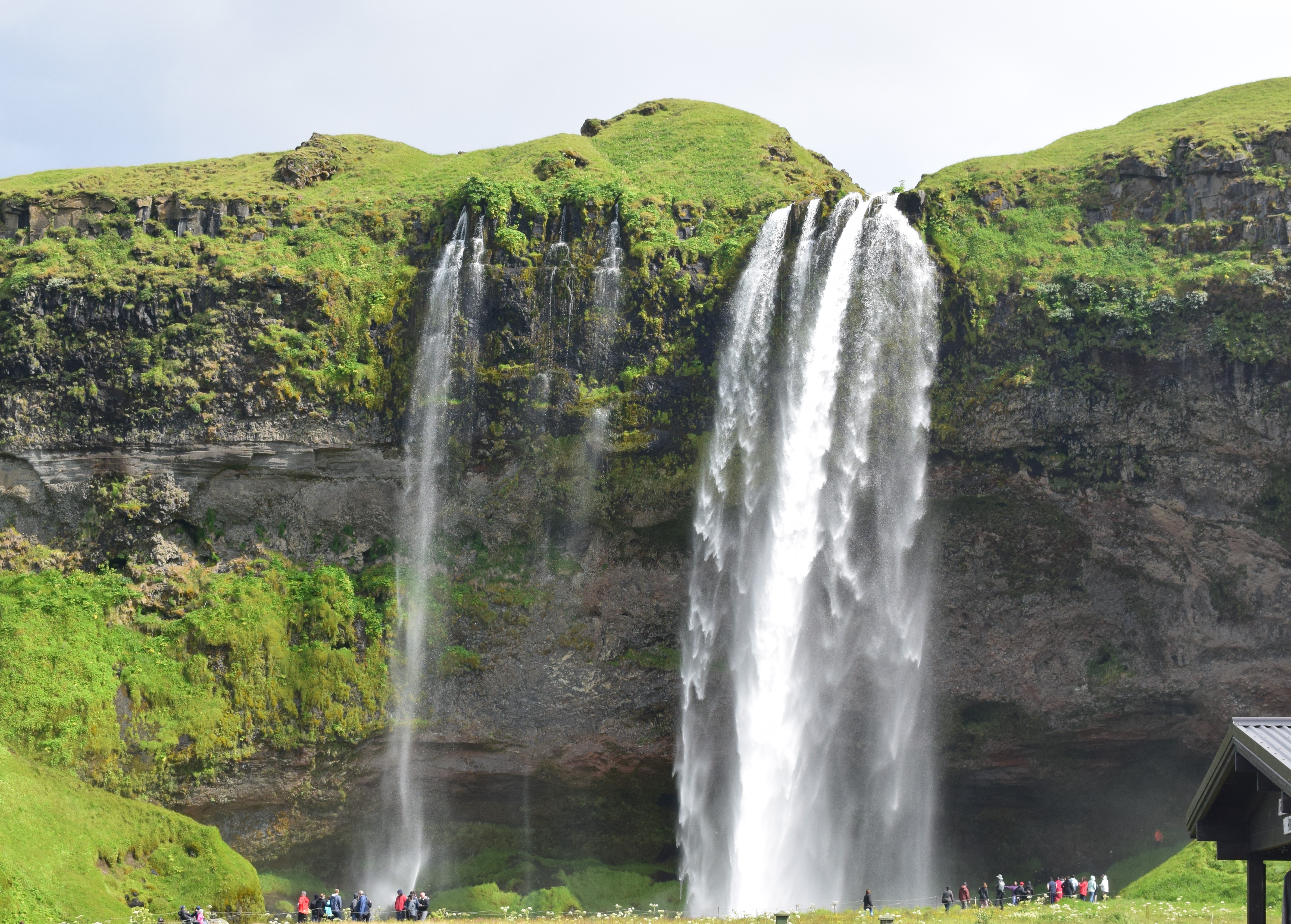
After that, we saw another waterfall called Seljalandsfoss. We were allowed to walk in a cave excavated by erosion, right behind the fall.

Finally, we visited the lava museum of Hvolsvöllür, which was very impressive with its decorated immersive rooms (with earthquake simulations and 3D models for instance), explaining all the different types of volcanic eruptions, lavas, and also the history of the local volcanoes and of Iceland’s formation. We learnt that there are 30 active volcanoes in Iceland, such as Hekla, Reykjaneshryggur or even Laki (the one linked to the origins of French Revolution). This massive presence of volcanoes is explained by the location of Iceland, which lies above a hot spot and a dorsal. Therefore, volcanoes and Earth material are still being created, shaping the territory. Because of this, Iceland is still exposed to lots of eruptions and earthquakes. For instance, the eruption of the Eyjafjallajökull, which happened in 2011, blocked the air traffic. The most recent eruptions took place in 2015.
Témoignages
Suivez notre actualité sur les réseaux sociaux :